


Navigation Screens 18
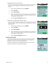
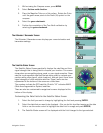
1. While viewing the Compass screen, press MENU.
2. Select Set true north direction.
3. Place the Magellan Triton on a flat surface. Rotate the Triton
until the green arrow points to the North (N) symbol on the
compass.
4. Select the green checkmark.
5. Confirm the completion of the True North calibration by
selecting the green checkmark.
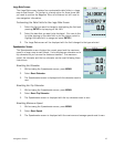
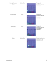
The Altimeter / Barometer Screen
The Altimeter / Barometer screen displays your current elevation and
barometer readings.
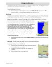
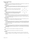
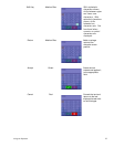
The Satellite Status Screen
The Satellite Status Screen graphically displays the satellites and their
signal strength that is being used to compute your location. This screen
shows when you are getting strong, weak, or poor signal reception. Green
satellite icons represent satellites that are being used to compute your
position while yellow (good), white (medium), and red (poor) icons show
signal strengths of other available satellites. Signal levels are also
represented at the bottom of the screen as colored bars.
The numbers indicate the GPS satellite ID while “W” indicates WAAS
(Wide Area Augmentation System) satellites.
There are also two customizable navigational screens displayed at the
bottom of the display.
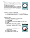
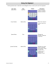
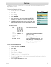
Customizing the Data Fields for the Satellite Status Screen
1. Select the field you want to change by highlighting the field and pressing ENTER.
2. Select the data that you want to be displayed. (You can do this by either tapping on the data
field or use the cursor control to highlight the data field in orange and press ENTER.)
3. The Satellite Status screen will be displayed with the field changed to the type selected.