


Fundamentals 1
Fundamentals
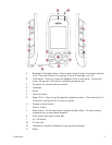
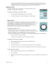
The Magellan Triton is a hand-held GPS receiver that has been designed for the outdoorsman. Simple
to use, yet powerful enough to get you through the toughest terrain or returning to that same fishing
hotspot, year after year.
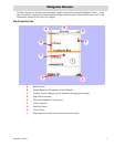
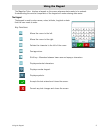
• Store waypoints that can include images for the complete experience.
• Record your track from start to finish and save it as a trail to be used over and over.
• Set a quick and easy Go To route from your current position to a stored waypoint or any
point on the map, simply and easily.
• Built-in flashlight to light your way in the dark.
• Load detailed Magellan maps with topographic or navaid information for the most detail
possible.
• Alarms can be set to alert you when you are nearing your destination, drifted off-course,
your boat has drifted from its anchor point as well as other alarms for a wide variety of
choices.
• View images stored on an SD card that can be used to assist you in arriving at the proper
location.
• Create a route from your current position to many different waypoints or places on the
map. Plan your day for the best use of your outdoor time.
The Magellan Triton is constantly being reviewed and updated to meet the outdoorsman’s needs. Be
sure to visit the support page at www.magellanGPS.com for firmware updates, keeping your Magellan
Triton running at it’s peak.
While you are checking for firmware updates, check the support section for additional FAQs as well as
updated manuals to assist you in the use of your Magellan Triton.
This document is set up to be printed on 8.5” x 11” (letter) paper should you desire a printed version
for your reference.