


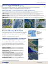
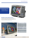

Navionics
®
Platinum+ with
Aerial View
Navionics
®
Platinum+ 3D
View
5
www.lowrance.com
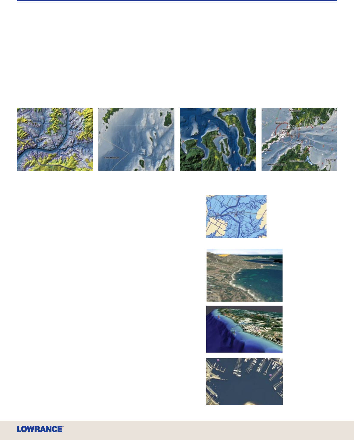
NEW Insight USA™ – A Charting Revolution in Detail and Resolution
Insight delivers unprecedented inland mapping and coastal charting detail with lightning-fast screen display updates. Amazing contour
shading lends life-like perspectives to bottom structure as well as topography. HDS Insight mapping choices include:
NEW Lake Insight™ U.S. inland mapping (for HDS-5) includes nearly 5,000 freshwater lake maps with life-like perspective of bottom
structure and topography. Coverage includes the Great Lakes and more than 500 Fishing Hot Spots
®
Lakes – a $400 value!
NEW Nautic Insight™ (for HDS-5) offers a superior like-like view of coastal bottom structure with detailed coastal and offshore depth
contours, plus nav aids, for the entire U.S. coastline.
NEW Insight USA™ (for HDS-7, -8 and -10 models) combines inland and coastal coverage ares of Lake Insight™ and Nautic Insight™.
Lowrance HDS Features
Fantastic High-Denition Mapping
Only Lowrance offers a stunning new world of cartography options that go to greater depths,
and heights, in dimensional GPS navigation reference and guidance.
Platinum+ and Platinum – Revealing 3D views of bottom structure,
and incredibly detailed satellite imagery, for the ultimate enhancement
to navigation and shing.
HotMaps Platinum – Fantastically detailed 3D lake surveys with
shing points of interest give marked advantages for the serious angler
and tournament competitor.
Exclusive TurboView™ Advantage – This exclusive HDS built-in
graphics engine delivers seamless zooms and 2D-3D chart displays,
real-time 3D map nav data overlay, striking depth views in 2D and 3D,
plus high-speed panning/zooming with detailed aerial views for all
Platinum chartcards, and seamless zoom for Navionics
®
Gold.
Plays Navionics
®
Favorites – HDS is also fully compatible with your
library of Navionics
®
Gold, Silver, Classic and HotMaps chartcards.
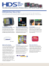
Expanded Basemap Marine Detail
HDS models with Enhanced U.S. Basemap offer the same
geographic coverage area as Insight, with over 100,000
bodies of water and nearly 5,000 enhanced U.S. lakes with
high detail lake shorelines and contours.
HDS Mapping Options Go All-Platinum
Your trusted favorites in Lowrance 2D mapping choices,
like Fishing Hot Spots
®
PRO and LakeMaster
®
ProMaps
are fully functional with HDS. Lowrance HDS expands
your world of high-detail, high-denition 3D charting
options with total compatibility for all 2009 (and earlier)
Navionics
®
chartcards.
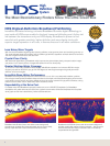
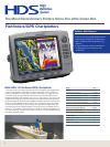
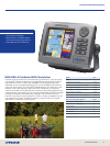
Lake Insight™
Amistad Reservoir, Texas
Lake Insight™
Lake Michigan, Michigan
Nautic Insight™
Nantucket Sound, Massachusetts
Nautic Insight™
Puget Sound, Washington
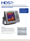
Enhanced
basemap
includes detailed
shoreline and
lake depth
contours
Navionics
®
Platinum+ with
TurboView™
Navionics
®
chart/mapping compatibilty with free HDS software upgrade in Q1 2009