


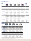


Cartography Options Part
All Navionics
®
charts www.navionics.com
LKPM-MI LakeMaster
®
ProMaps Michigan 108-202
LKPM-MN LakeMaster
®
ProMaps Minnesota 108-203
LKPM-WI LakeMaster
®
ProMaps Wisconsin 108-204
FHSP-N Fishing Hot Spots
®
PRO North 108-205
FHSP-E Fishing Hot Spots
®
PRO East 108-206
FHSP-S Fishing Hot Spots
®
PRO South 108-207
FHSP-W Fishing Hot Spots
®
PRO West 108-208
F101EX-N FreedomMaps™ USA EX North 108-209
F102EX-E FreedomMaps™ USA EX East 108-210
F103EX-S FreedomMaps™ USA EX South 10 8 -211
F104EX-W FreedomMaps™ USA EX West 108-212
F105EX-A&H FreedomMaps™ USA EX Alaska/Hawaii 108-213
F110EX-NC FreedomMaps™ Canada EX North Central 108-214
F111EX-WC FreedomMaps™ Canada EX West Central 108-215
F112EX-EC FreedomMaps™ Canada EX East Central 108-216
MC-7 MapCreate™ Series 7 Accessories Pack 095-61
NP-USA NauticPath USA Coastal 108-129
NP-Caribbean 108-192
NP-Central America/West 108-193
NP-South America 108-194
NP-Europe West 108-195
NP-Europe North 108-196
NP-Mediterranean 108-197
NP-Africa/MiddleEast/India 108-198
NP-SEAsia/PacicIsland 108-199
NP-Australia/NewZealand 108-200
NP-Japan/East Asia 108-201
41
www.lowrance.com
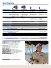
Cartography
Inland Land
FreedomMaps™ USA EX
Expanded coverage on high-capacity SD memory cards for the whole
USA. Features over 3,000 lakes with depth contours. Plus topo detail
including elevations and hunting databases, cities/highways/
landmarks, searchable Points-of-Interests and much more. Great
detail and each a great deal in a choice of ve broad geographic
regions.
F101EX-N - MT, WY, ND, SD, NE, MN, IA, MI, WI, IL, IN
F102EX-E - ME, VT, NH, MA, NY, CT, NJ, PA, DE, RI, MD, WV, OH,
VA, KY, TN, NC, SC, GA, AL, FL
F103EX-S - AZ, NM, CO, KS, OK, TX, MO, AR, LA, MS
F104EX-W - CA, NV, UT, ID, OR, WA
F105EX-A&H - AK, HI
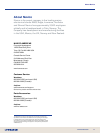
Inland Land
FreedomMaps™ Canada EX
Superbly-detailed electronic Canadian mapping with land-based topo
data coverage for virtually all provinces and territories. Each SD
memory card features world class map data from DMTI Spatial, with
cities – towns, highways, city – rural roads, railways, rivers, streams,
lakes-ponds, detailed shorelines, province – municipality boundaries,
topographical contours, plus searchable Points-of-Interests, and much
more.
F110EX-NC - Nunavut, Northwest Territories, Yukon Territory, British
Columbia, Alberta, Saskatchewan, Manitoba, Ontario, Quebec,
Newfoundland, Labrador and Hudson Bay.
F111EX-WC - British Columbia, Alberta, Saskatchewan, Manitoba,
Yukon NT and Nunavut, Great Slave Lake, Lake Superior, Hudson Bay,
plus Seattle and Spokane coverage.
F112EX-EC - Manitoba, Ontario, Quebec, Newfoundland, Labrador,
Prince Edward Island, Nova Scotia, New Brunswick, Hudson Bay and
all Great Lakes, plus Milwaukee, Chicago, Toledo, Detroit, Cleveland,
Buffalo and Syracuse.
Inland Land/Marine
USA Series-7 Accessories Pack
The complete, enhanced and expanded Lowrance system to make
your own detailed topo mapcards over and over on your PC, with
coverage for all 50 states. One DVD includes over 3,000 lakes with
depth contours, topo contours with elevation markers, enhanced
shorelines detail, 2 million Points-of-Interests, exclusive hunting
databases, cities, highways, landmarks and scores more. Includes SD
card reader-writer and blank, high-capacity SD memory card for a
surprisingly low price!
Compatible for PC systems with Pentium 133 Mhz or higher and a DVD drive,
64MB RAM (128MB recommended), 200MB free hard disc space, high-color
(16 bit) display, Microsoft® Windows
®
98 or higher.
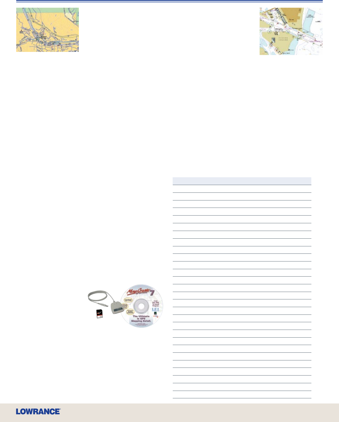
Coastal
NauticPath™ USA Coastal
Detail-rich marine charting, preloaded
on SD memory card for your Lowrance
GPS, for one amazing low price.
NauticPath™ USA Coastal delivers
incredible, object-oriented detail with
shaded depth contours, intertidal zones,
spot soundings, wrecks, nav aids, port plans, restricted areas,
anchorages, lights, tides – currents, expansive chart information
(number, name, scale, etc.) and other navigation features. Just one
card gives you expansive electronic chart coverage of the East, West,
Gulf, Hawaii, and Alaska coasts, the Great Lakes, plus the Bahamas,
Puerto Rico, and the U.S. Virgin Islands - all with the appearance of
paper charts with seamless vector graphics. All this without unlock
codes or added costs makes Lowrance NauticPath™ coastal
electronic charts an unequalled marine cartography value!
Coastal
NauticPath™ International
When going global, you can experience the same high-level
NauticPath™ offshore/coastal navigational electronic chart detail and
information, with worldwide coverage choices, at an affordable price
point compared to any other. Each NauticPath™ International choice is
preloaded on SD memory card for plug-and-play convenience with
your compatible Lowrance GPS. For exhibits on individual chartcard
coverage areas, visit the Mapping area of the Lowrance website.