


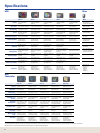
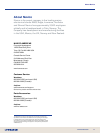

HDS-10 HDS-8 HDS-7 HDS-5 HDS-5x M68c
Display
10.4” Diag. (26.4 cm)
16-bit color SolarMAX™
PLUS TFT
8.4” Diag. (21.3 cm)
16-bit color SolarMAX™
PLUS TFT
6.4” Diag. (16.3 cm)
16-bit color SolarMAX™
PLUS TFT
5” Diag. (12.7 cm)
16-bit color SolarMAX™
PLUS TFT
5” Diag. (12.7 cm)
16-bit color SolarMAX™
PLUS TFT
3.5” Diag. (8.9 cm)
256-color Active Matrix TFT
Resolution
Super VGA 600V x 800H pixels Super VGA 600V x 800H pixels Full VGA 480V x 640H pixels
High Contrast
480V x 480H pixels
High Contrast
480V x 480H pixels
High Contrast
320V x 240H pixels
Backlighting
Pure white LED screen/
keypad adjusts to zero dim
Pure white LED screen/
keypad adjusts to zero dim
Pure white LED screen/
keypad adjusts to zero dim
Fluorescent cold cathode
adjustable screen/keypad
Fluorescent cold cathode
adjustable screen/keypad
White LED adjustable
screen/keypad
Power
250W/32W RMS actual;
30,000W/3,750W RMS
analog equivalent
250W/32W RMS actual;
30,000W/3,750W RMS
analog equivalent
250W/32W RMS actual;
30,000W/3,750W RMS
analog equivalent
250W/32W RMS actual;
30,000W/3,750W RMS
analog equivalent
250W/32W RMS actual;
30,000W/3,750W RMS
analog equivalent
800W/100W RMS
Operating Frequency
50/200 kHz or 83/200 kHz 50/200 kHz or 83/200 kHz 50/200 kHz or 83/200 kHz 50/200 kHz or 83/200 kHz 50/200 kHz or 83/200 kHz
200 kHz with Deep Water
Pack choice
Depth Capability
To 5,000’ (1,524 m)
Based on transducer*
To 5,000’ (1,524 m)
Based on transducer*
To 5,000’ (1,524 m)
Based on transducer*
To 5,000’ (1,524 m)
Based on transducer*
To 5,000’ (1,524 m)
Based on transducer*
To 600’ (183 m) and
To 800’ (244 m) with
Deep Water Pack
Operating Voltage
10-17V DC 10-17V DC 10-17V DC 10-17V DC 10-17V DC 10-17V DC
GPS Receiver/
Antenna
Internal high-sensitvity
16-channel GPS + WAAS+
EGNOS+ MSAS
Internal high-sensitvity
16-channel GPS + WAAS+
EGNOS+ MSAS
Internal high-sensitvity
16-channel GPS + WAAS+
EGNOS+ MSAS
Internal high-sensitvity
16-channel GPS + WAAS+
EGNOS+ MSAS
None
Internal 12-channel
GPS+WAAS
Waypoint
Management
5,000 waypoints, 200 routes, 10
trails up to 12,000 points each;
specic icons for navigation
and shing
5,000 waypoints, 200 routes, 10
trails up to 12,000 points each;
specic icons for navigation
and shing
5,000 waypoints, 200 routes,
10 trails up to 12,000 points
each; specic icons for
navigation and shing
5,000 waypoints, 200 routes, 10
trails up to 12,000 points each;
specic icons for navigation
and shing
Waypoints with network only
Up to 1,000 waypoints &
1,000 event markers, up to
100 routes & 100 plot trails;
42 different marker icons
Communication
NMEA 2000
®
, NMEA 0183,
Lowrance Ethernetworks
compatible
NMEA 2000
®
, NMEA 0183,
Lowrance Ethernetworks
compatible
NMEA 2000
®
, NMEA 0183,
Lowrance Ethernetworks
compatible
NMEA 2000
®
, NMEA 0183,
Lowrance Ethernetworks
compatible
NMEA 2000
®
, NMEA 0183,
Lowrance Ethernetworks
compatible
NMEA 0183
Languages
English, Spanish, French
Portuguese
English, Spanish, French
Portuguese
English, Spanish, French
Portuguese
English, Spanish, French
Portuguese
English, Spanish, French
Portuguese
Ten (10) menu selections
Memory Card Slots
Two (2) SD/MMC slots for
cartography, or recording sonar
and navigation data
Two (2) SD/MMC slots for
cartography, or recording sonar
and navigation data
One (1) SD/MMC slots for
cartography, or recording sonar
and navigation data
One (1) SD/MMC slots for
cartography, or recording sonar
and navigation data
None None
Case Size
8.85” H (22.5 cm)
12.28” W (31.2 cm)
3.63” D (9.2 cm)
Sealed and waterproof,
suitable for saltwater use
7.76” H (19.7 cm)
10.59” W (26.9 cm)
3.68” D (9.4 cm)
Sealed and waterproof,
suitable for saltwater use
6.46” H (16.4 cm)
8.78” W (22.3 cm)
3.46” D (8.8 cm)
Sealed and waterproof,
suitable for saltwater use
5.72” H (14.5 cm)
7.24” W (18.4 cm)
3.46” D (8.8 cm)
Sealed and waterproof,
suitable for saltwater use
5.72” H (14.5 cm)
7.24” W (18.4 cm)
3.46” D (8.8 cm)
Sealed and waterproof,
suitable for saltwater use
5.8” H (14.7 cm)
4.3” W (10.8 cm)
2.5” D (6.4 cm)
Sealed and
waterproof,
suitable for
saltwater use
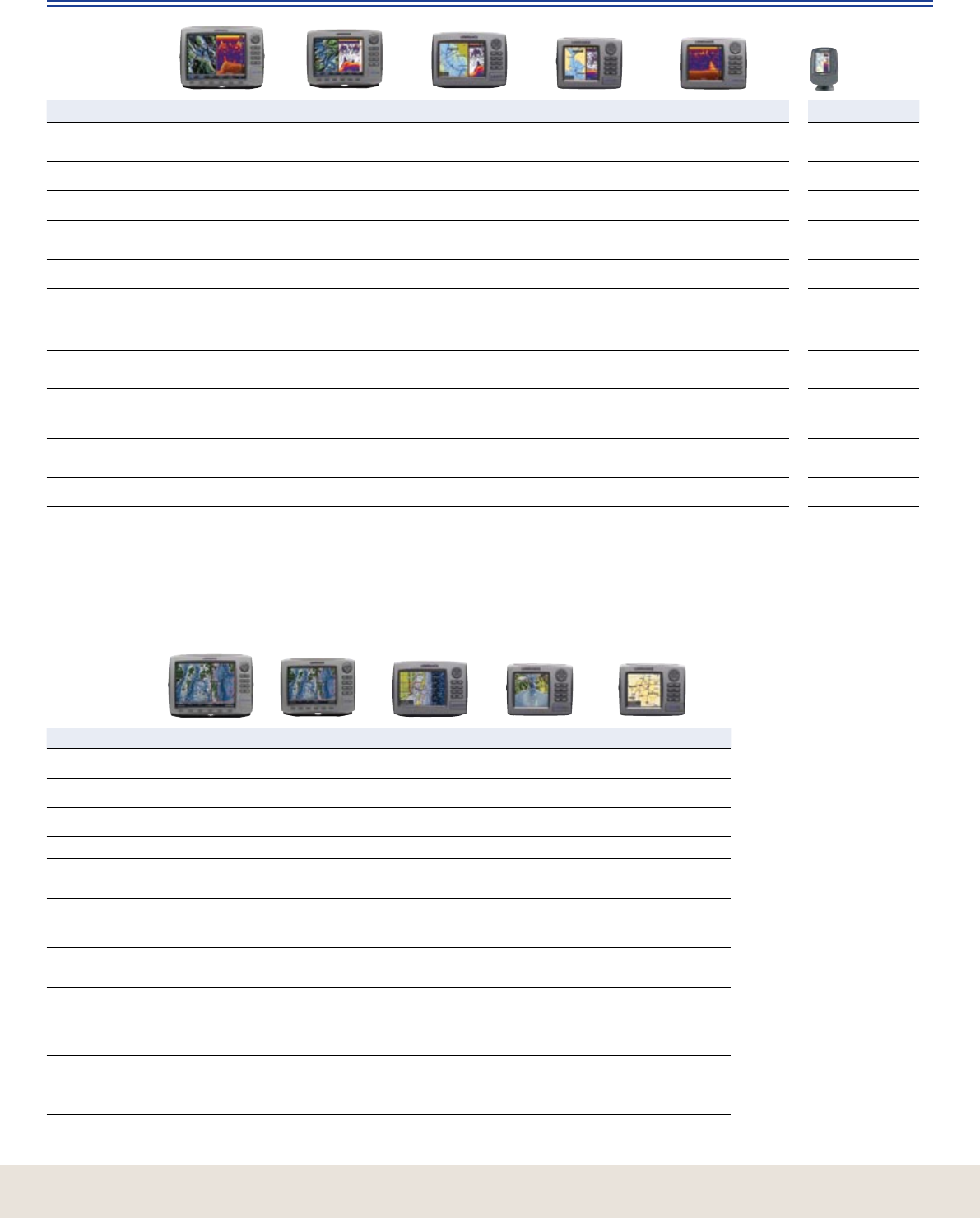
HDS-10m HDS-8m HDS-7m HDS-5m HDS-5 Baja
Display
10.4” (26.4 cm) 16-bit color
SolarMAX™ PLUS TFT
8.4” (21.3 cm) 16-bit color
SolarMAX™ PLUS TFT
6.4” (16.3 cm) 16-bit color
SolarMAX™ PLUS TFT
5” (12.7 cm) 16-bit color
SolarMAX™ PLUS TFT
5” (12.7 cm) 16-bit color
SolarMAX™ PLUS TFT
Resolution
Super VGA
600V x 800H pixels
Super VGA
600V x 800H pixels
Full VGA
480V x 640H pixels
High contrast
480V x 480H pixels
High contrast
480V x 480H pixels
Backlighting
Pure white LED screen/
keypad adjusts to zero dim
Pure white LED screen/
keypad adjusts to zero dim
Pure white LED screen/
keypad adjusts to zero dim
Fluorescent cold cathode
adjustable screen/keypad
Fluorescent cold cathode
adjustable screen/keypad
Operating Voltage
10-17V DC 10-17V DC 10-17V DC 10-17V DC 10-17V DC
GPS Receiver/
Antenna
Internal high-sensitivity
16-channel GPS +WAAS+
EGNOS+ MSAS
Internal high-sensitivity
16-channel GPS +WAAS+
EGNOS+ MSAS
Internal high-sensitivity
16-channel GPS +WAAS+
EGNOS+ MSAS
Internal high-sensitivity
16-channel GPS +WAAS+
EGNOS+ MSAS
Internal high-sensitivity
16-channel GPS +WAAS+
EGNOS+ MSAS
Waypoint
Management
5,000 waypoints, 200
routes, 10 trails up to 12,000
points each; specic icons
for navigation and shing
5,000 waypoints, 200
routes, 10 trails up to 12,000
points each; specic icons
for navigation and shing
5,000 waypoints, 200
routes, 10 trails up to 12,000
points each; specic icons
for navigation and shing
5,000 waypoints, 200
routes, 10 trails up to 12,000
points each; specic icons
for navigation and shing
5,000 waypoints, 200 routes,
10 trails up to 12,000 points
each; specic icons for
navigation and shing
Communication
NMEA 2000
®
, NMEA 0183,
Lowrance Ethernetworks
compatible
NMEA 2000
®
, NMEA 0183,
Lowrance Ethernetworks
compatible
NMEA 2000
®
, NMEA 0183,
Lowrance Ethernetworks
compatible
NMEA 2000
®
, NMEA 0183,
Lowrance Ethernetworks
compatible
NMEA 2000
®
, NMEA 0183,
Lowrance Ethernetworks
compatible
Languages
English, Spanish, French
Portuguese
English, Spanish, French
Portuguese
English, Spanish, French
Portuguese
English, Spanish, French
Portuguese
English, Spanish, French
Portuguese
Memory Card
Slots
Two (2) SD/MMC slots for
cartography, or recording
sonar and navigation data
Two (2) SD/MMC slots for
cartography, or recording
sonar and navigation data
One (1) SD/MMC slots for
cartography, or recording
sonar and navigation data
One (1) SD/MMC slots for
cartography, or recording
sonar and navigation data
One (1) SD/MMC slots for
cartography, or recording
sonar and navigation data
Case Size
8.85” H (22.5 cm)
12.28” W (31.2 cm)
3.63” D (9.2 cm)
Sealed and waterproof,
suitable for saltwater use
7.76” H (19.7 cm)
10.59” W (26.9 cm)
3.68” D (9.4 cm)
Sealed and waterproof,
suitable for saltwater use
6.46” H (16.4 cm)
8.78” W (22.3 cm)
3.46” D (8.8 cm)
Sealed and waterproof,
suitable for saltwater use
5.72” H (14.5 cm)
7.24” W (18.4 cm)
3.46” D (8.8 cm)
Sealed and waterproof,
suitable for saltwater use
5.72” H (14.5 cm)
7.24” W (18.4 cm)
3.46” D (8.8 cm)
Sealed and waterproof,
suitable for saltwater use
42
HDS Other
HDS
Chartplotter
Specications
* Actual depth capabilities depend on transducer conguration and installation, bottom composition and water conditions. All sonar units typically read deeper in fresh water than salt water.
HDS products for use in North and South America only. All functions not available outside these regions.