


16 GPS 72H Owner’s Manual
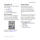
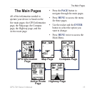
The Main Pages
Map Tab—you can turn on or off
MapSource
®
, customize latitude
and longitude grid distance, and
customize the grid labels.
Waypoint Tab—size and zoom
setting for Waypoints and Active
Route Waypoints.
Point Tab—size and zoom
setting for Navaids, Points of
Interest, Geo, and Exit option.
Line Tab—Zoom scale settings
for Track Log, Saved Tracks,
Active Route, and the Off/On
setting for the Bearing Line.
City Tab—Text and Zoom scale
settings for Large City, Medium
City, Small City and Small Town.
Other Tab—On/Off settings for
the Accuracy Circle and Heading
Line.
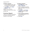
To restore Map page defaults, select
MENU > Setup Map > MENU >
Restore Defaults.
•
•
•
•
•
•
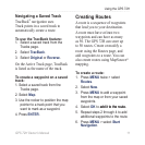
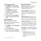
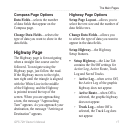
Compass Page
The Compass page guides you to
your destination with a graphic
compass display and a bearing or
course pointer.
Bearing
pointer
Vertical
line
Compass Page
The rotating compass ring indicates
the direction you are heading. The
bearing and course pointers indicate
the direction (bearing to or course of
travel) to your destination, relative
to your current heading direction.
Choose a bearing pointer or course
pointer for guidance.