


GPS 400 Quick Reference
190-00140-61 Rev. E
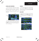
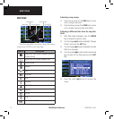
MAP PAGE
12
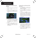
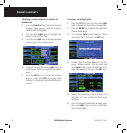
MAP PAGE
Present Position
Desired Track
Data Fields
Map Range
Map Display
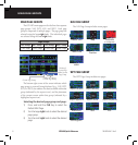
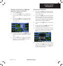
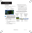
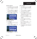
The following symbols are used to depict the various
airports and NAVAIDs on the Map Page:
Symbol Description
Airport with hard surface runway(s); (primary
runway shown)
Airport with soft surface runway(s) only
Private Airfield
Heliport
VOR
VOR/DME
DME
Localizer
Intersection
VORTAC
TACAN
NDB
Locator Outer Marker
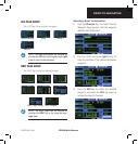
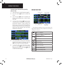
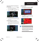
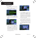
Selecting a map range:
1) Press the up arrow of the RNG Key to zoom
out to a larger map area.
2) Press the down arrow of the RNG Key to zoom
in to a smaller map area and more detail.
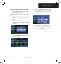
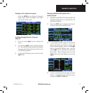
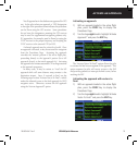
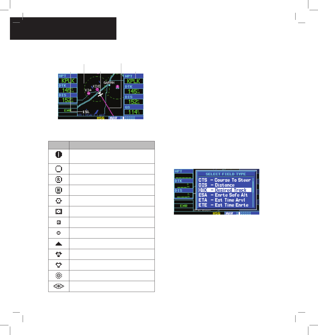
Selecting a different data item for any data
field:
1) With Map Page displayed, press the MENU
Key to display an options menu.
2) Turn the large right knob to highlight ‘Change
Fields?’ and press the ENT Key.
3) Turn the large right knob to highlight the data
field to be changed.
4) Turn the small right knob to select the desired
type of data for this field and press the ENT
Key.
5) Press the small right knob to remove the
cursor.