


1 2 3
6
5
4
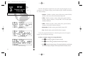
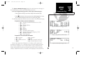
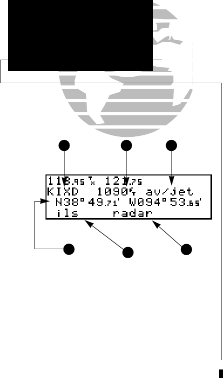
The airport position page displays the latitude, longitude and elevation of the
selected airport, as well as usage or fuel availability, available approaches and airport
control/radar capability. The following descriptions and abbreviations are used on the
airport position page:
Elevation— In feet or meters
Usage/Fuel— If the airport is for military use, it will display ‘military’.
If it is private, the GNC 250 will display ‘private’. If it is a pub-
lic airport, it will display the fuel type(s) available:
• av gas— 80-87 octane, 100 LL, 100-130 octane, or mogas is
available
• jet— Jet A, Jet A-1 or Jet A+ fuel is available
• av/jet— Both av gas and jet fuel are available
Position— In degrees/minutes or degrees/minutes/seconds of latitude
and longitude.
Approach Information— displays the airport approaches available
• no apr— No approach is available
• np-apr— Non-precision approach is available
• loc— Localizer approach is available
• ils— ILS approach is available
Controlled Airspace Information— displays controlled airspace type
• class B • cta
• class C • tma
Radar— displays approach/departure radar capability
• radar— indicates radar is present
38
REFERENCE
Intersections &
User Waypoints
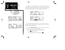
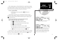
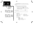
Airport Position Page
1. Identifier (selectable)
2. Elevation
3. Fuel Availability
4. Airport Position
5. Approach Information
6. Controlled Airspace/Radar Capability
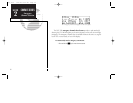
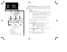
SECTION
3
WPT KEY
Airport
Position Page
250 real 7/14/98 9:32 AM Page 38