


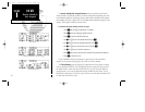
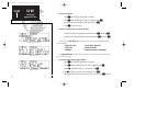

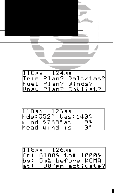
The GNC 250’s winds aloft function is used to calculate the true direction and
speed of the any winds, and indicates whether you are flying with a head wind or tail
wind, and the wind speed.
To calculate winds aloft:
1. Press
N
and rotate
O
until NAV Menu 1 is displayed.
2. Press
C
twice and rotate
O
until ‘Winds?’ is highlighted. Press
E
.
3. Use
K
and
O
to enter your present heading in the ‘hdg:’ field. If your installation
includes a fuel/air data computer, this will be displayed automatically. Press
E
.
4. Use
K
and
O
to enter your true airspeed (TAS) in the ‘tas:’ field. If you have previously
calculated it using the density altitude/true air speed function, it will be displayed as the
default. Press
E
. The wind direction and speed and head/tail wind will be displayed.
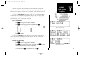
The VNAV function calculates vertical speed requirements to reach a desired altitude before
or after a specified distance from a waypoint. This is helpful when you’d like to descend to a cer-
tain altitude near an airport or climb to an altitude before reaching a route or direct-to waypoint.
To calculate vertical navigation parameters:
1. Press
N
and rotate
O
until NAV Menu 1 is displayed.
2. Press
C
twice and rotate
O
until ‘Vnav Plan?’ is highlighted. Press
E.
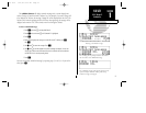
3. Use
K
and
O
to enter the initial (from) altitude. Your GPS altitude will be displayed
as the default. Press
E
.
4. Use
K
and
O
to enter the desired final (to) altitude. Press
E
.
5. Use
K
and
O
to enter the distance from the waypoint. Press
E
.
6. Use
K
to select ‘before’ or ‘after’ the waypoint. Press
E
.
7. Use
K
and
O
to select the waypoint identifier (it must be a waypoint in the active route
or a direct-to waypoint). Press
E
.
22
REFERENCE
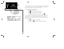
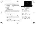
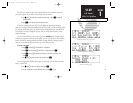
Date & Time,
Trip Timer
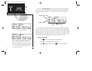
Winds Aloft Page
NAV Menu 1
Vertical Navigation Page
SECTION
1
NAV KEY
Winds Aloft &
VNAV Functions
250 real 7/14/98 9:32 AM Page 22