


GPSMAP 5000 Series Owner’s Manual 37
Conguring the Device
ConfiGUrinG
the deViCe
Speed Sources—specify the sensor used for Wind numbers and Fuel Economy. Touch Wind or Fuel
Economy to toggle between Water (from a water-speed sensor) and GPS (from the calculated GPS
speed).
Auto Guidance—
sets the Automatic Guidance parameters for your boat:
Safe Depth—sets the minimum depth (chart depth datum) to allow when calculating an
automatic guidance path. A safe depth of less than one meter is not allowed when using
Automatic Guidance.
Safe Height—sets the minimum height (chart height datum) of a bridge that your boat can safely
travel under.
Shoreline Distance—set how close you want to travel near the shore: Nearest, Near, Normal,
Far, or Farthest. This is used by the automatic guidance calculation to determine how close
to the shoreline you want the automatic-guidance line to be. Changing this while navigating an
automatic-guidance line will recalculate the path.
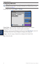
Conguring Units of Measure
From the Home screen, touch Congure > Preferences > Units.
System Units—global setting that denes individual units of measure at the same time. Statute
(mh, ft, ºF), Metric (kh, m, ºC), Nautical (kt, ft, ºF), or Custom. Touch Custom to individually
dene units of measure for:
Depth—individually set the units of measure for depth to Feet, Fathoms, or Meters.
Temperature
—individually set the units of measure for temperature to Fahrenheit (ºF) or
Celsius (ºC).
NOTE: You must be receiving NMEA Sonar depth data or using a Garmin sounder module to view
depth and temperature information.
Distance—individually set the units of measure for distance readings (Miles, Kilometers, or
Nautical Miles).
Speed—individually set the units of measure for speed readings (Miles Per Hour, Kilometers
Per Hour, or Knots).
Elevation
—individually set the units of measure for elevation readings (Feet or Meters).
Volume—individually set the units of measure for volume readings (Liters, US Gallons, or UK
Gallons).
Pressure—individually set the units of measure for gauge (kPa or psi) and atmospheric
(Millibars or Inches of Mercury) pressure readings.
Heading—set the reference used in calculating heading information.
Auto Mag Var (
Automatic Magnetic Variation)—automatically set the magnetic declination for
your location.
True
—set true north as the heading reference.
Grid—set grid north as the heading reference (000º).
User Mag Var—set the magnetic variation value.
Position Format—set the coordinate system in which a given location reading appears. Do not
change the position format unless you are using a map or chart that species a different position
format.
•
•
•
•
•
•
•
•
•
•
•
•
•
•