


NAVI-B VERSION 1.01
2 Preparing to use your FALCOM NAVI-B
Read this manual in order to begin using your FALCOM NAVI-B and to
understand its operations, functions, and common features.
You must first install a GPS Mapping software (if none is installed) on your
PC, laptop, PDA, or other handheld devices.
In order to have a Bluetooth™ connection with your Falcom NAVI-B,
secure that the control device is a Bluetooth-enabled one.
For more information about software installation, please refer to chapters
described below.
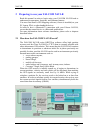
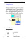
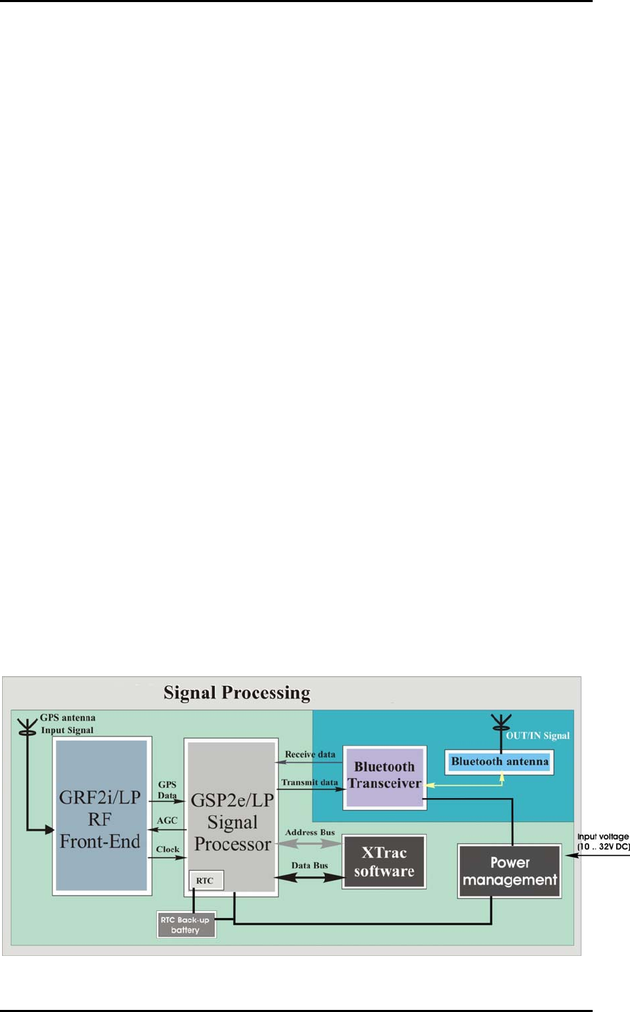
2.1 How does the FALCOM NAVI-B work?
The FALCOM NAVI-B using SiRFXTrac software offers high position
accuracy and fast Time-To-First-Fix (TTFF) than is currently possible with
other autonomous GPS solution. This means that the NAVI-B will continue
to determinate its positions or obtain an initial fix in places previously not
possible. In other word the NAVI-B can be used in environments previously
deemed inaccessible environments such as:
severe urban canyons,
parking garages,
dense foliage,
multi-level freeways,
under bridges and overpasses, and, in many cases, indoors.
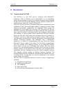
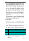
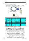
Coverage - Single Story Office Block
When the GPS receiver is initially turned on, it begins to determinate its
current positions, velocity and time which will be calculated from tracking
the GPS signals an extremely small level by 16 dBHz. While trying to
calculate a position fix, the receiver needs to be locked-on to at least four
satellites. In order to calculate quickly its current location, the receiver uses
the current received signals from in view satellites, simultaneously holds the
stored data from its memory (SRAM).
This confidential document is the property of FALCOM GmbH and may not be copied or circulated without permission.
Page 7