GPS GENERAL INFORMATION
2
GPS Basics
The Global Positioning System (GPS) is a space-based radio-
navigation system. It consists of 24 satellites, which orbit the
Earth at an altitude of approximately 11,000 miles, and
ground stations. GPS provides users with accurate information
on position, velocity and time. This is available anywhere in
the world and in most weather conditions.
GPS was initiated in 1973 to reduce the proliferation of
navigation aids by the United States Department of Defense.
By creating a robust system that overcame the limitations of
many previously existing navigation systems, GPS became
attractive to a broader spectrum of users. GPS has been
successful in classic applications such as aviation and marine
navigation since it was first developed. Since then, it has
become useful for a wide range of people because its
capabilities are accessible using small, affordable equipment.
What was once available only in very expensive equipment,
Cobra
®
brings to you with our high-quality line of affordable
handheld GPS receivers
How GPS Works
GPS uses a global network of 24 satellites that transmit radio
signals to earth from high earth orbit. Thankfully for users,
the United States has offered free use of the system to the
international community. Many international user groups have
accepted GPS as the core for an international civil satellite
navigation capability.
GPS service provides users with extremely accurate
positioning information anywhere on or near the surface of
the earth. To accomplish this, each of the 24 satellites emits
signals to receivers below. GPS determines location by
computing the difference between the time that a signal is
sent and the time it is received. GPS satellites carry atomic
clocks that provide extremely accurate time information. The
time information is placed in the codes broadcast by the
satellite so that a receiver can continuously determine the
time the signal was broadcast. The signal contains data
that your Cobra
®
GPS receiver uses to compute the locations
of the satellites and to make other adjustments needed for
accurate positioning. Your Cobra
®
GPS receiver uses the time
difference between the time of signal reception and the
broadcast time to compute the distance, or range, from the
receiver to the satellite. With information about the ranges
to four satellites and the location of each satellite when
the signal was sent, your Cobra
®
receiver can compute its
own three-dimensional position: latitude, longitude, and
altitude. People think of GPS as having three segments:
the control, space and user segments. What follows is
a little information about each segment.
Control Segment
The Control Segment of GPS consists of the Master Control
Station, Monitor Stations and Ground Antennas.
The one master control station, located at Falcon Air Force
Base in Colorado Springs, Colorado, USA is responsible for
overall management of the remote monitoring and
transmission sites. As the center for support operations, it
calculates any position or clock errors for each individual
satellite, based on information received from the monitor
stations. Then it "orders" the appropriate ground antennas to
relay the corrective information back to that satellite.
Five monitor stations are located at Falcon Air Force Base in
Colorado, Hawaii, Ascension Island in the Atlantic Ocean,
Diego Garcia Atoll in the Indian Ocean and Kwajalein Island in
the South Pacific Ocean. Each of the monitor stations checks
the exact altitude, position, speed and overall health of the
orbiting satellites. The control segment uses measurements
collected by the monitor stations to predict each satellite's
orbit and clock. The prediction data is up-linked, or
transmitted, to the satellites for transmission back to the
continued
WELCOME TO THE COBRA
®
GPS 100
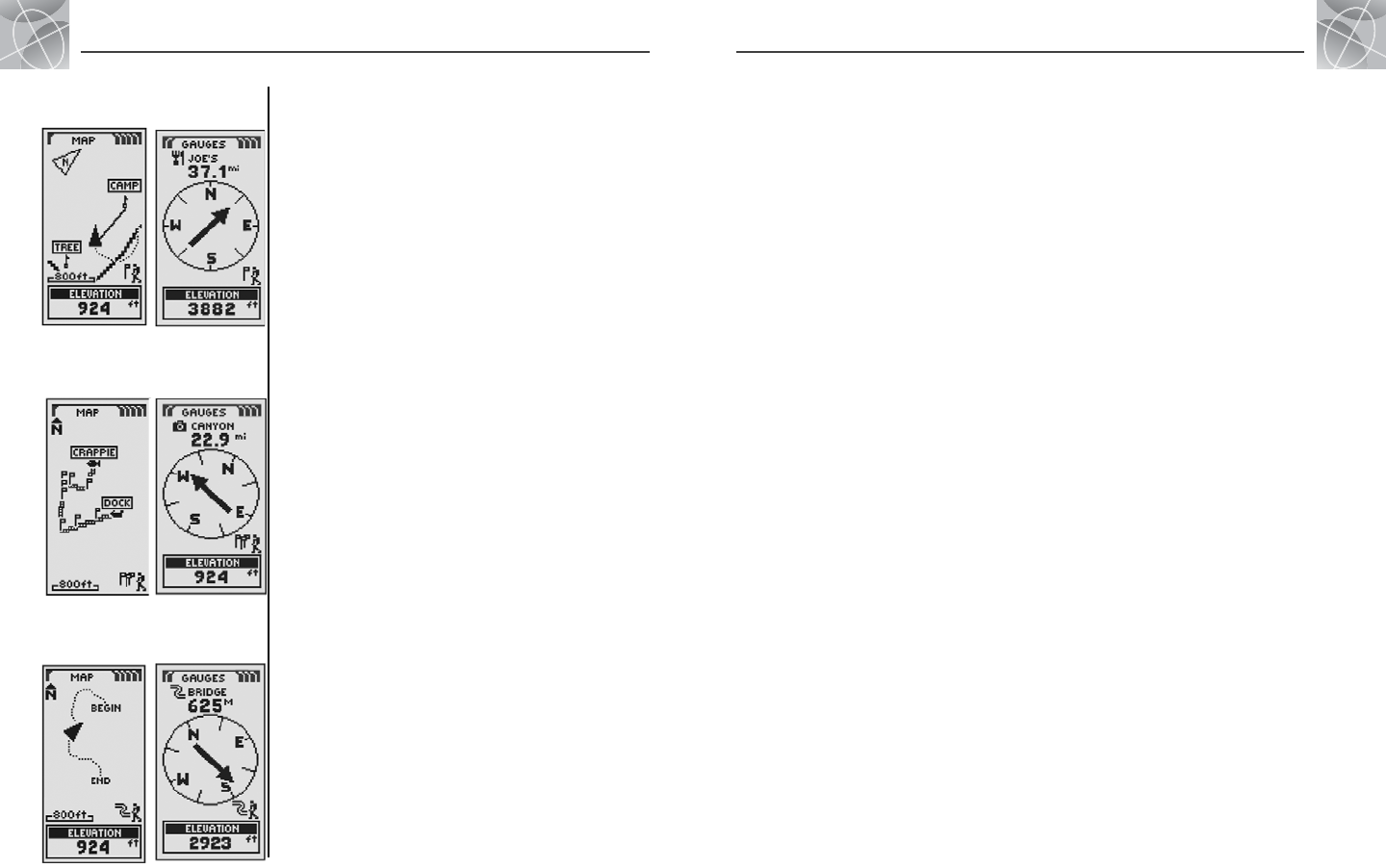
Ẅ “GoTo” on
Map Page
ẅ “GoTo” on
Gauges Page
Ẇ Navigate
Route On
Map Page
ẇ Navigate
Route on
Gauges Page
Making Travel Easier
Your Cobra
®
GPS 100 receiver makes travel easier through three
major ways:
GoTo a Waypoint – The GPS 100 guides you in a straight line
to a single point. (See Ẅ and ẅ )
Navigate a Route – The GPS 100 gives you the opportunity to
select two or more waypoints to create a route. You can then use
your GPS 100 to guide you in a straight line from point to point
through your stored route. (See Ẇ and ẇ )
Navigate a Track – The GPS 100 automatically keeps a record
of your progress as you travel and gives you a graphic representation or
“track log” of the path or track you have taken. You can use the track
log to create a track that you can recall for navigation. The track can be
navigated in the forward or the reverse direction of the original travel.
(See Ẉ and ẉ )
This manual is designed to help you take advantage of these and our
many other features. We suggest that you begin by reading the “General
Information” and “System Sections” first. If you are not familiar with the
satellite navigation technology, these will help you understand the basics.
Then, take your Cobra
®
GPS receiver outside and practice while you read the
sections on how to operate it.
Ẉ Navigate
Track on
Map Page
ẉ Navigate
Track on
Gauges Page
1
Go to Table of Contents


