


Black plate (62,1)
Cadillac Escalade/Escalade ESV Owner Manual - 2011
7-62 Infotainment System
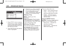
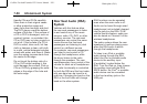
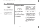
U (Space): Select to enter a
space between characters or the
words of a name.
Backspace: Select if an incorrect
character has been entered.
To make name entries easier,
the system only highlights the
characters that can follow the last
one entered. For example, if a Z is
entered, a T may not be available
for selection.
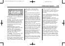
If a name does not display after
entry, it may need to be entered
differently or the map DVD disc
may not contain that information.
See Maps on page 7‑62 for more
information.
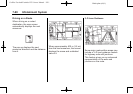
Maps
This section includes basic
information that you need to
know about the map database.
The maps are stored on a compact
flash drive that is built into the
navigation system.
Detailed Areas
Road network attributes are
contained in the map database for
detailed areas. Attributes include
information such as street names,
street address, turn restrictions,
etc. A detailed area includes all
major highways, service roads,
and residential roads. The detailed
areas include points of interest
(POI) such as: restaurants, airports,
banks, hospitals, police stations,
gas stations, tourist attractions,
historical monuments, etc. The map
database may not include data for
newly constructed areas or map
database corrections that are
completed after the production
of the compact flash drive.
The navigation system provides
full route guidance in the detailed
map areas.
Limited Guidance Areas
Any area that is not classified as
detailed, is a limited guidance
area. Limited guidance streets are
displayed on the map but route
guidance may not be given on these
streets. Some POI categories, such
as the city center POI category, and
some street addresses are included
in the limited guidance areas.
The navigation system informs
through voice prompts when you
are traveling into a limited guidance
area where route guidance is not
available. The street maps and the
directional arrow displayed on the
navigation system can then be used
to determine the remaining route to
your destination.
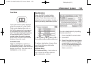
Map Adjustmen ts
The system lets you adjust the scale
of view on the map. Also, as you
drive, the map scrolls automatically
based on the direction of travel.