


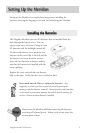
ii Magellan Meridian GPS Receiver
Reference
Power/Backlight/Contrast ..................................................................... 18
Turn the Meridian On ................................................................................. 18
Turn the Meridian Off................................................................................. 18
Using the Display Backlight......................................................................... 18
Adjusting the Display Contrast .................................................................... 19
Selecting NAV Screens ................................................................................. 19
Returning to Last Viewed NAV Screen ........................................................ 19
Map Screen ........................................................................................... 19
Setting the Map Detail................................................................................. 22
Customizing the Map Display ..................................................................... 23
Turning On/Off Display Waypoints ...................................................... 23
Turning On/Off Track Lines .................................................................. 23
Turning On/Off Topographic Lines ....................................................... 23
Turning On/Off Displayed POI’s .......................................................... 24
Globally Turning Map Items On/Off..................................................... 24
Setting Up Map Data Fields......................................................................... 24
Turning Data Fields On/Off .................................................................. 25
Selecting the Data Fields ........................................................................ 25
Two Data Fields Description.............................................................. 25
Changing the Data Fields .............................................................. 25
Street Information Description .......................................................... 27
Horizontal Profile Description ........................................................... 27
Terrain Projection Description ........................................................... 27
Changing the Map Orientation ................................................................... 28
Selecting Primary Usage............................................................................... 28
Selecting Track Mode ................................................................................... 29
Auto vs. Auto Detailed........................................................................... 29
Using Vertical Profile ................................................................................... 30
Selecting Vertical Profile......................................................................... 30
Track History Description ..................................................................... 30
Route Vertical Profile Description.......................................................... 31
Highlighted Road Vertical Profile Description ....................................... 31
Path Check Description ......................................................................... 31