


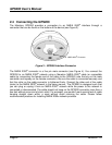


GPS200 User’s Manual
Page 6 Revision 1.2
These parameters may be configured using a Maretron display (DSM250), or the parameters
can be configured using a Maretron NMEA 2000
®
/USB gateway (USB100) and Maretron’s
N2KAnalyzer software.
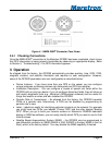
Users with direct access to the NMEA 2000
®
interface may configure these parameters directly
through the NMEA 2000
®
interface. Please refer to Appendix A for a description of the NMEA
2000
®
messages used to configure these parameters.
3.1 Magnetic Variation
Magnetic variation is the angular difference between the true meridian (great circle connecting
the geographic poles) and the magnetic meridian (direction of the lines of magnetic flux).
Magnetic variation has different values at different locations on the earth with most areas
undergoing change to the magnetic variation over time.
The GPS200 indicates magnetic variation anywhere on Earth using the World Magnetic Model
(WWM). It is important to understand that the WMM geomagnetic model only characterizes
that portion of the Earth’s magnetic field that is generated in the Earth’s fluid outer core (the
main magnetic field). The portions of the geomagnetic field generated by the Earth’s crust and
upper mantle, and by the ionosphere and magnetosphere, are not represented in the WMM.
Consequently, a magnetic sensor such as a compass or magnetometer may observe spatial
and temporal magnetic anomalies when referenced to the WMM. In particular, certain local,
regional, and temporal magnetic declination anomalies can exceed 10 degrees. Anomalies of
this magnitude are not common but they do exist. Declination anomalies of the order of 3 or 4
degrees are not uncommon but are of small spatial extent and are relatively isolated.
On land, spatial anomalies are produced by mountain ranges, ore deposits, ground struck by
lightning, geological faults, and cultural features such as trains, planes, tanks, railroad tracks,
power lines, etc. The corresponding deviations are usually smaller at sea, and decrease with
increasing altitude of an aircraft or spacecraft. In ocean areas, these anomalies occur most
frequently along continental margins, near seamounts, and near ocean ridges, trenches, and
fault zones, particularly those of volcanic origin. Ships and submarines are also sources of
magnetic anomalies in the ocean.
However, from a global main field perspective, the declination (D), inclination (I), and grid
variation (GV) RMS errors of WMM are estimated to be less than 1.0° at the Earth’s surface
over the entire 5-year life span of the model. Also, the RMS errors at the Earth’s surface
horizontal intensity (H), the vertical component (Z), and the total intensity (F) of WMM are
estimated to be well below 200 nT over the entire 5-year life of the model. Thus, the WMM
meets and exceeds the accuracy requirements detailed in MIL-W-89500 (Defense Mapping
Agency, 1993) for the entire life span of the model. To learn more about the WWM, please visit
http://www.ngdc.noaa.gov/geomag/WMM/DoDWMM.shtml.
4 Maintenance
Regular maintenance is important to ensure continued proper operation of the Maretron
GPS200. Perform the following tasks periodically: