


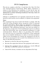

44
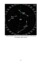
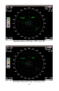
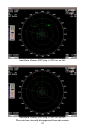
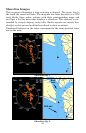
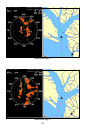
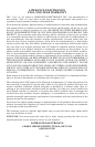
Shoreline Images
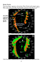
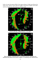
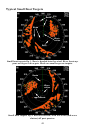
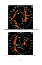
This sequence illustrates a boat entering a channel. The green line is
the track the vessel will take. The magenta line from the stern is a GPS
trail. Study these radar returns with their corresponding maps and
you'll get a feel for how radar displays a shoreline. This channel is sur-
rounded by steeply sloping, rocky hills. Radar signals are strictly line-
of-sight, so this causes land further inland to show no return.
Numbered features on the radar correspond to the same position num-
ber on the map.
Shoreline fig. 1.
Shoreline fig. 2.
1
1
7
7
8
9
10
2
3
4
5
6
6
8
10
4
9
2
3
5
1
7
8
9
10
2
3
4
5
6
1
7
6
8
10
9
2
3
5
4
10
12
11
11
12
13
14
15
13
14
15
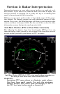
GPS trail
Boat
track