


Cirrus Perspective
®
by Garmin – Cockpit Reference Guide for the SR20/SR22
190-00821-03 Rev. A 57
Additional Features
Flight
Instruments EIS
Nav/Com/
XPDR/Audio AFCS GPS Nav
Flight
Planning Procedures
Hazard
Avoidance
Additional
Features
Abnormal
Operation
Annun/
Alerts Appendix Index
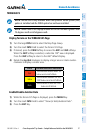
Adjusting the EVS Display
1)
Turn the large FMS Knob to select the AUX Page Group.
2)
Turn the small FMS Knob to select the VIDEO Page.
3)
Press the SETUP Softkey. The EVS display adjustment softkeys are now
displayed.
4)
Pressing the CNTRST - and CNTRST + Softkeys adjust display contrast in
five percent increments from 0 to 100%.
5)
Pressing the BRIGHT - and BRIGHT + Softkeys adjust display brightness in
five percent increments from 0 to 100%.
6)
Pressing the SAT - and SAT + Softkeys adjust display saturation in five
percent increments from 0 to 100%.
7)
Pressing the RESET Softkey returns all video adjustments options to the
default settings
8)
Press the BACK Softkey to return to the previous softkey level, or after
45 seconds of softkey inactivity, the system reverts to the top level AUX -
VIDEO Page softkeys.
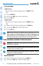
TERMINAL PROCEDURE CHARTS
NOTE: With the availability of SafeTaxi
®
, ChartView, or FliteCharts
®
in
electronic form, it is still advisable to carry another source of charts on-board
the aircraft.
SafeTaxi
®
SafeTaxi
®
is an enhanced feature that gives greater map detail as the map range
is adjusted in on the airport. The airport display on the map reveals runways with
numbers, taxiways identifiers, and airport landmarks including ramps, buildings,
control towers, and other prominent features. Resolution is greater at lower map
ranges. The aircraft symbol provides situational awareness while taxiing.
Pressing the DCLTR Softkey (declutter) once removes the taxiway markings and
airport identification labels. Pressing the DCLTR Softkey twice removes VOR station
ID, the VOR symbol, and intersection names if within the airport plan view. Pressing
the DCLTR Softkey a third time removes the airport runway layout, unless the airport
in view is part of an active route structure. Pressing the DCLTR Softkey again cycles
back to the original map detail.