


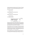
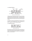

4.1 WAYPOINT DEFINITION
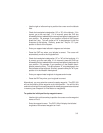
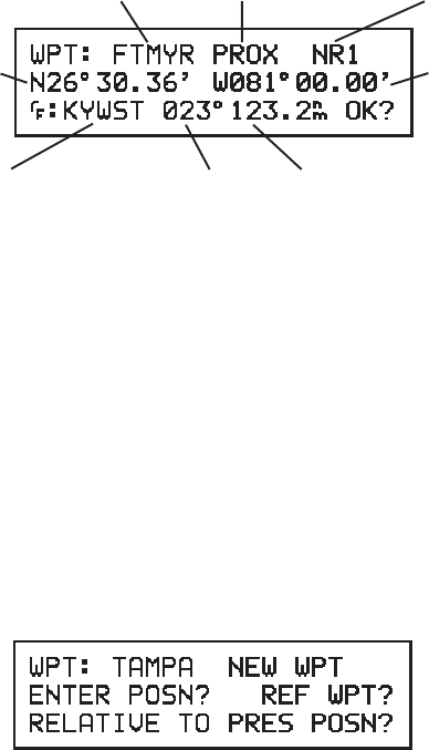
Waypoint Proximity Nearest
Name Indicator Waypoint Indicator
Latitude Longitude
Reference Waypoint Bearing & Range from Reference
WAYPOINT DEFINITION PAGE
The Waypoint Definition Page displays the waypoint name (up to 5 characters),
its latitude/longitude, and an optional reference. The reference waypoint
option allows you to compute the relative position (range and bearing) of the
displayed waypoint from a better known location. The reference for each
waypoint will be stored in memory to help you remember where the waypoint
is located.
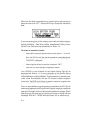
If the waypoint is used as a proximity alarm (see section 4.8 for more
information), it will be indicated by “PROX” on line 1. Additionally, if the
waypoint is one of the 9 nearest waypoints, it will be indicated by “NRx” on
line 1 (“x” ranges from 1 to 9, with 1 meaning the closest).
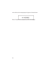
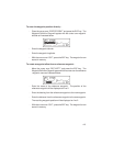
4.2 CREATING WAYPOINTS
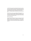
NEW WAYPOINT PAGE
When a waypoint name has been entered that does not exist in memory, the
GPS 100 will assume you wish to create a new waypoint. The New Waypoint
Page will ask you to select one of three methods for defining the waypoint
position: direct latitude/longitude entry, relative to an existing waypoint, or
relative to your present position.
4-2