


10
190-00356-01 Rev E
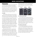
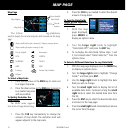
MAP PAGE
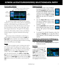
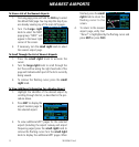
Map Page
User-selectable
Data Fields
Map Display
Present
Position
Map Scale
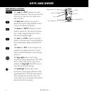
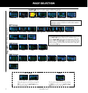
The follow- ing symbols are
used to depict the various airports and navaids on the map
page:
Airport with hard surface runway(s); Primary runway shown
Airport with soft surface runway(s) only
Private Airfield Intersection
VOR VORTAC
VOR/DME TACAN
DME NDB
Localizer Locator Outer Marker
Heliport
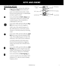
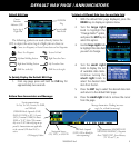
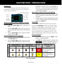
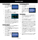
To Select a Map Scale
1. Press the up arrow on the RNG key to zoom out
to a larger map area.
2. Press the down arrow on the RNG key to zoom in
to a smaller map area
with more detail.
To Quickly Declutter the
Map Display
The 400W series supports
four levels of map decluttering.
1. Press the CLR key momentarily to change the
amount of map detail. The declutter level will
appear adjacent to the map scale.
2. Press the CLR key as needed to select the desired
amount of map detail.
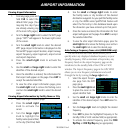
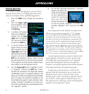
To Turn the Data Fields
On/Off on the Right Side
of the Map
1. With the map
page displayed,
press MENU to
display an options menu.
2. Turn the large right knob to highlight
“Data Fields Off?” and press the ENT key.
3. To re-display the data fields, follow steps 1 and
2, but instead select “Data Fields On?” from the
options menu.
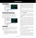
To Select a Different Data Item for any Data Field:
1. With the map page displayed, press the MENU key
to display an options menu.
2. Turn the large right knob to highlight “Change
Fields?” and then press ENT.
3. Use the large right knob to highlight the data
field you wish to change.
4. Turn the small right knob to display the list of
available data items. Continue turning the small
right knob to select the desired data item from
the list.
5. Press the ENT key to select the desired data item
and return to the map page.
6. Press the small right knob momentarily to remove
the cursor from the page.