


16 GPSMAP 400/500 Series Owner’s Manual
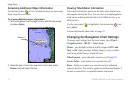
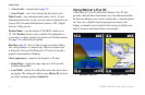
Using Charts
Active Tracks—manage tracks (page 27).
Saved Tracks—view a list of tracks that have been saved.
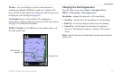
Other Vessels
—view information about other vessels. To view
information about other vessels, your unit must be connected to an
external AIS (Automatic Identication System) or DSC (Digital
Selective Calling) device.
Weather Radar
—turn the display of NEXRAD weather on or
off. (The Weather feature is only available if the chartplotter is
connected to a weather module and you have an XM subscription.)
See page 55 for additional information.
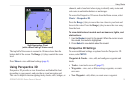
Data Bars
(page 9)—show or hide cruising, navigation, shing,
fuel, sailing numbers, or compass tape. When on, compass tape
is displayed at the top of the Perspective 3D screen to provide a
graphical representation of heading.
Chart Appearance
—customize the Perspective 3D chart.
Range Rings—toggles the range rings on or off to provide
distance measurement.
Lane Width
—adjusts the width of the course line drawn when
navigating. This setting also affects routes (Route To), but does
not affect automatic guidance (Guide To).
•
•
•
•
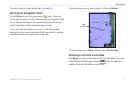
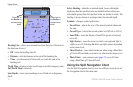
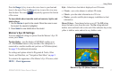
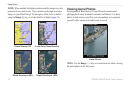
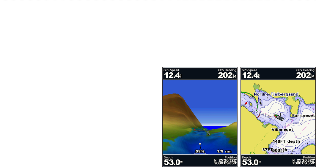
Using Mariner’s Eye 3D
A BlueChart g2 Vision SD card offers Mariner’s Eye 3D, that
provides a detailed three-dimensional view from above and behind
the boat (according to your course), and provides a visual navigation
aid. This view is helpful when navigating tricky shoals, reefs,
bridges, or channels, and is benecial when trying to identify entry
and exit routes in unfamiliar harbors or anchorages.
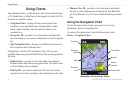
Mariner's Eye 3D Navigation Chart