


28
Downloading, Uploading and Storing Satellite (Aerial) Photos and Topo Maps
Now that you are familiar with your Bushnell ONIX series GPS, you are ready to take advantage of
many of the easy to use exclusive Bushnell features. In conjunction with your Bushnell GPS unit,
you have two additional tools that make your ONIX the most functional GPS for your next outdoor
excursion– BushnellGPS.com and the ONIX CD with the GPS PC Companion program.
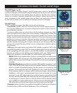
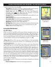
The BushnellGPS.com Website
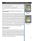
Bushnellgps.com provides access to Satellite Imagery and Topographic Map downloads so that you
can create detailed maps of your specific area of interest. BushnellGPS.com (or through Bushnell.
com) enables you to plan your next adventure by searching and viewing Satellite Imagery and
Topographic maps. Here’s how to get started:
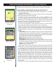
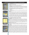
• Log onto www.bushnellgps.com
• Click on “Download Images and Register your GPS”. Register your GPS unit.
• As a rst time user, set up a Login Account and Password
• Connect your ONIX GPS to your computer via the included USB cable
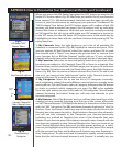
• Once your account is established, you can start browsing the website. The Help le on the “My Map”
webpage provides step by step details explaining how to search for, purchase, and download your
maps, including Satellite Images and Topographic maps.
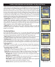
• BushnellGPS.com saves your images in your folders on our safe and secure server so that you can
access them at any time.
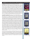
• After you complete an outdoor excursion, BushnellGPS.com also enables you to upload all of your
trip’s navigation information into your account folders to review, and analyze, and save for the next
return trip.
• BushnellGPS.com also provides detailed GPS product features and specications, Software Update
Downloads, Troubleshooting and Frequently Asked Questions, and the Bushnell Shopping Cart to
purchase accessories, Photo/Map downloads, and printable Photos/Maps.
So log on, log in, and start downloading to experience a whole new world of GPS functionality.
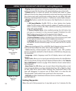
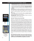
The Bushnell GPS ONIX CD-ROM
Your CD contains software to help you get the most out of the ONIX GPS:
1. The ONIX GPS PC Companion program – Click the link to download and install the latest version of
“GPS PC Companion” onto your PC. The PC Companion enables you to plan and save your GPS trips
on your PC. Similar to the website, you can upload and save waypoints, trails, routes, photos and maps
between your GPS and PC, so you can trip plan even when you are not connected to the internet and
BushnellGPS.com. Take your PC along on your next adventure and the GPS PC Companion provides
the perfect tool for storing and analyzing all of your GPS information.
2. A pdf copy of this QuickStart Guide.
Visit www.BushnellGPS.com for a detailed GPS glossary, frequently asked questions
(FAQ), and other useful information related to the ONIX series GPS receivers.
DOWNLOADS / BushnellGPS.com / CDROM