149
Entertainment OverviewControlsDriving hintsNavigationMobilityReference
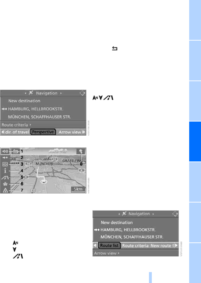
Displaying map view
Professional navigation system:
You can have the car's position shown on a
map. After starting route guidance, the planned
route is shown on the map.
1. Select "Navigation" and press the control-
ler.
2. Move the highlighted marker to the fourth
field from the top. Turn the controller until
the desired map view is selected:
> "Map north-oriented"
> "Map, indicating dir. of travel"
> "Perspective"
3. Press the controller.
1 Switching spoken instructions on/off
2 Starting/ending guidance
3 Selecting the destination via map
4 Displaying/hiding information last selected,
see Selecting the destination via Informa-
tion, page 140
5 Changing map view
> "Map north-oriented"
> "Map, indicating dir. of travel"
> "Perspective"
6 Altering route criteria
7 Calling up traffic information manually
8 Arrow to destination as the crow flies
The estimated time of arrival and the distance
from the destination are displayed on the bot-
tom line of the control display.
To exit the menu:
Select the arrow and press the controller.
If the scale is smaller than 500 km or 250 miles,
you can choose whether to align the map point-
ing towards north, in the direction of travel, or
in perspective. At scales from 500 km or
250 miles upward, the map is always displayed
pointing towards north.
Changing map view
Select the corresponding symbol and press the
controller.
The next map view is displayed.
Changing the scale
Turn the controller to alter the scale.
Displaying roads and places along the
route
You can have the roads and towns along the
route displayed during route guidance.
The distances to be covered along each section
of the route are likewise displayed.
1. Select "Navigation" and press the control-
ler.
2. Move the highlighted marker to the third
field from the top. Turn the controller until
"Route list" is selected and press the con-
troller.
Online Edition for Part-No. 01 41 0 159 725 © 09/05 BMW AG
