Route guidance
154
Representation of traffic information in
the map view
Professional navigation system:
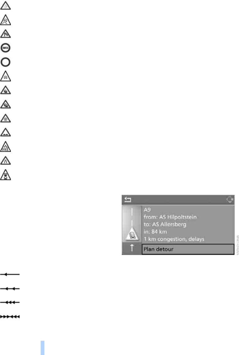
The traffic information symbols are shown in
the map view up to a scale of 200 km or
100 miles.
At scales of up to 10 km or 5 miles, additional
information is displayed. The length, direction
and severity of traffic congestion are shown by
arrows along the route, e.g.:
Along the planned route
Symbol with red border, together with the traffic
obstruction symbol.
Away from the planned route
> Map scale up to 10 km or 5 miles:
Symbol with grey border, together with the
traffic obstruction symbol
> Map scale from 20 km or 10 miles:
Symbol with grey border and an arrow
pointing in the appropriate direction
Traffic information during route
guidance
If the navigation system receives traffic infor-
mation and "Dynamic route" is not selected,
within approx. 100 km, approx. 50 miles of the
traffic obstruction, you are provided with spe-
cific information such as the length of the con-
gestion.
The last possible turning to leave the route is
displayed to you shortly before you reach it.
This information is still displayed if you have
called up another application on the control dis-
play.
Avoiding congestion
Professional navigation system:
Select "Plan detour" and press the control-
ler.
The navigation system calculates a new
route to avoid the congestion and then
takes you back onto the original route.
Fog
Slippery road
Cross winds
Smog
Road closed
Risk of hold-ups
Stop-and-go traffic
Congestion
Icy roads
Uneven surface
Accident
Narrow road
Delay
Slow-moving traffic
Stop-and-go traffic
Congestion
Congestion in both directions
Online Edition for Part-No. 01 41 0 159 725 © 09/05 BMW AG


