


7
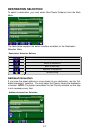
INTRODUCTION TO YOUR NAVIGATION SOFTWARE
Navigation software provides turn-by-turn visual and voice assistance to direct
you to your selected destination. The software quickly calculates step-by-step
directions to any destination available on the included navigation map.
The Navigation software uses Global Positioning System (GPS) satellites, and
a digital roadway map database to calculate and display travel directions. The
system’s GPS antenna receives signals from a constellation of 24 satellites
orbiting the earth and uses the strongest of signals, to determine your position
to within meters.
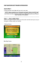
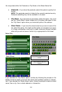
Vehicle Position
The Navigation software’s computer considers vehicle speed and heading
changes, together with longitude and latitude information, to accurately deter-
mine vehicle heading and position on a digital map.
Signals from GPS satellites are used to determine the vehicle location. Three
(good) or four (best) satellites must be received to accurately determine
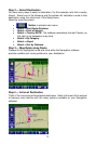
location. The GPS reception status is indicated by the GPS symbol on the map.
Map and Information Database
The map database used by your Navigation software was created using
high-resolution aerial and land based data collection.
Car navigation maps are frequently updated. While the database was judged to
be as accurate as possible at the time of its release, a map database can never
be 100% accurate. Road information that is maintained in the map databases,
such as turn restrictions or road names may change over time.