


13
RSA-1200L User Manual
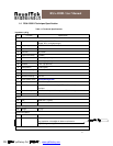
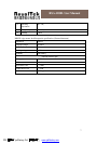
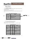
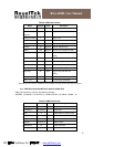
Geoid Separation meters
Units M meters
Age of Diff. Corr. second
Null fields when DGPS is not
used
Diff. Ref. Station ID 0000
Checksum *18
<CR><LF>
End of message termination
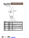
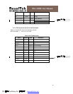
Table 2-3 Position Fix Indicators
Value Description
0 Fix not available or invalid
1 GPS SPS Mode, fix valid
2 Differential GPS, SPS Mode, fix valid
3-5 Not Supported GPS PPS Mode, fix valid
6 Dead Reckoning Mode, fix valid
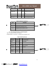
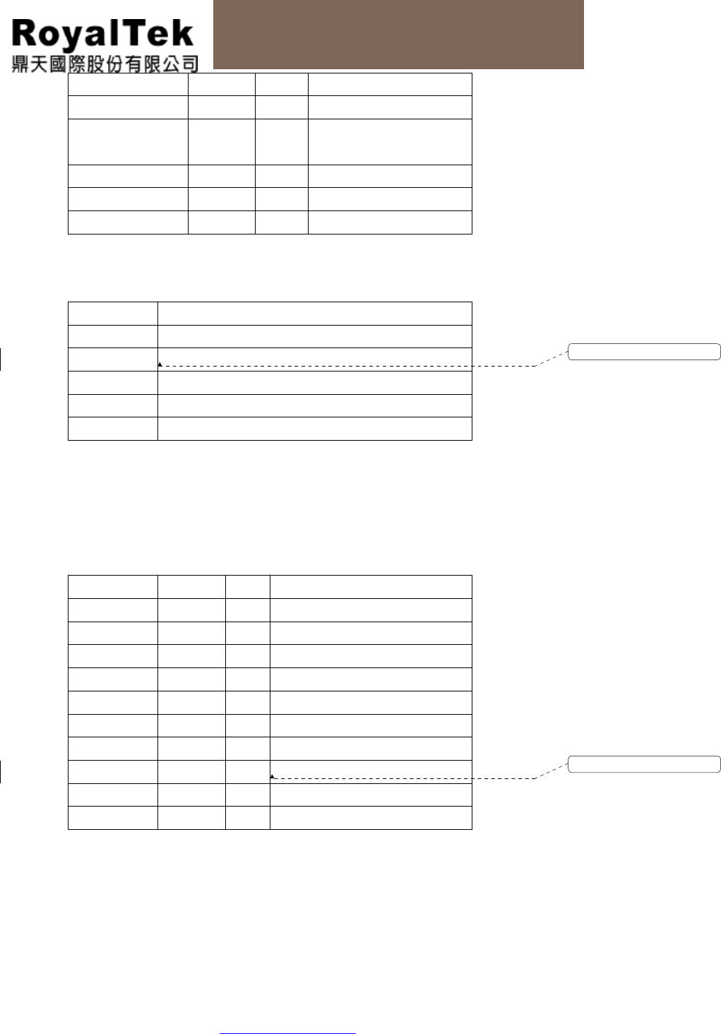
2.1.2 GLL-Geographic Position –Latitude/Longitude
Table 2-4 contains the values of the following
Example: $GPGLL, 3723.2475, N, 12158.3416, W, 161229.487, A*2C
Table 2-4 GLL Data Format
Name Example
Units
Description
Message ID $GPGLL GLL protocol header
Latitude 3723.2475
ddmm.mmmm
N/S Indicator N N=north or S=south
Longitude 12158.3416
Dddmm.mmmm
E/W Indicator W E=east or W=west
UTC Position 161229.487
hhmmss.ss
Status A A=data valid or V=data not valid
Mode A A=Autonomous, D=DGPS, E=DR
Checksum *2C
<CR><LF>
End of message termination
格式化: 法文 (法國)
格式化: 法文 (法國)
PDF 檔案以 "pdfFactory Pro" 試用版建立 ÿ www.pdffactory.com