


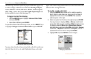
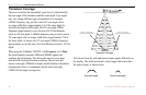

BASIC OPERATION > USING THE MAIN MENU
28 Fishfinder 250/250C Owner’s Manual
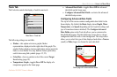
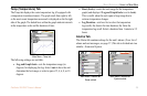
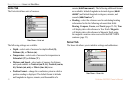
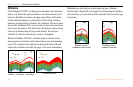
Units Tab
The Units tab defines units of measure.
Main Menu—Units tab
The following settings are available:
• Depth—select units of measure for depth in Feet (ft),
Fathoms (fa), or Meters (m).
• Temperature—select units of measure for temperature in
Fahrenheit (°F) or Celsius (°C).
• Distance and Speed—select units of measure for distance
and speed readouts in Nautical (nm/ft, kt), Nautical (nm/m,
kt), Statute (mi, mh), or Metric (km, kh) terms.
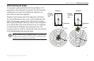
• Position Format—change the coordinate system in which a
position reading is displayed. The default format is latitude
and longitude in degrees, minutes, and thousandths of a
minute (hddd°mm.mmm’). The following additional formats
are available: latitude/longitude in decimal degrees (hddd.
ddddd°) and latitude/longitude in degrees, minutes, and
seconds (hddd°mm’ss.s”).
• Heading—select the reference used in calculating heading
information for the the following advanced data fields:
Bearing, Compass, Course, and Track (pages 23-24). True
will display data with reference to True North. Magnetic
will display data with reference to Magnetic North using
the magnetic variation value received in the RMC NMEA
sentence (page 23).
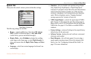
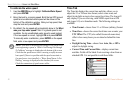
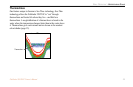
Sonar Tab
The Sonar tab allows you to initialize settings and calibrations.
Main Menu—Sonar tab