


TRACKER 5505/5505i/5605 Installation and Operation Manual
19
NAVMAN
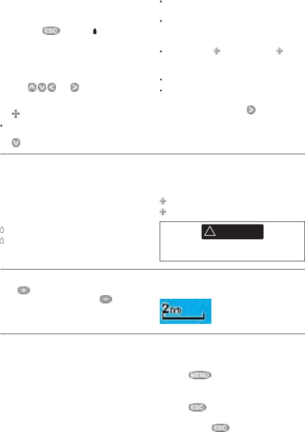
The chart scale is displayed at the top left of
the chart:
3-2-2 Latitude and longitude
Latitude and longitude can be displayed in
the data header. The display is degrees and
minutes to three decimal places, about 2 m
(6 ft) resolution. Normally the position is the
boat’s position, and the latitude and longitude
has a boat symbol to show this:
36° 29.637’ N or S Latitude
175° 09.165’ E or W Longitude
3-2-1 Chart modes
The Chart has two modes:
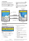
Centre on boat mode
To switch to centre on boat mode in the chart
display, press . The boat is at the centre
of the chart. As the boat moves through the
water, the chart automatically scrolls to keep
the boat in the centre of the chart. The cursor
(see below) is turned off.
Cursor mode
The keys and are called cursor
keys. To switch to cursor mode in the chart
display, hold down a cursor key. The cursor
appears and moves away from the boat:
Press the key which points in the direction
that the cursor will move, for example press
to move the cursor down.
Press midway between two of the cursor
keys to make the cursor move diagonally.
Hold a cursor key down to make the cursor
move continuously across the display.
In Cursor mode:
The distance ( DST) and bearing ( BRG)
of the cursor from the boat are displayed at
the bottom, left corner of the display.
The chart does not scroll as the boat moves.
If the cursor reaches the edge of the
display, the chart will scroll.
For example, hold down to move the
cursor to the right side of the display and
the chart will scroll to the left.
If the cursor has been moved in the last ten
seconds, then the position is the cursor’s
position, and the latitude and longitude has a
cursor symbol to show this:
36° 29.841’ N or S Latitude
175° 09.012’ E or W Longitude
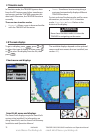
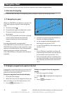
3-2-3 Chart scale
Press to zoom in and display a smaller area
of the chart in more detail. Press to zoom
out and display a bigger area in less detail.
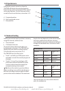
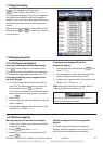
3-2-4 Chart symbols and information
The chart will show symbols, such as waypoints
and chart symbols (for example buoys,
beacons, wrecks and marinas). When the
cursor is placed over a symbol for at least two
seconds, a data window appears at the bottom
left of the display with information about the
symbol.
To see stored information about a point on the
chart (for example, a chart symbol):
1 Move the cursor to that point on the chart.
2 Press and select Chart info.
3 A menu of objects is displayed:
i Select an object to display.
ii Press to return to the menu. Select
other objects.
iii Finally, press to return to the chart.
CAUTION
!
!
CAUTION
DANGER
WARNING
When reading the boat position, make sure
the position is not the cursor position.
www.Busse-Yachtshop.de email: info@busse-yachtshop.de