


27Magellan SporTrak GPS Receiver
Reference
Terrain Projection, the default Two Data Fields is displayed. Changing
the Orientation back to “Track Up” will revert back to the projected
terrain.
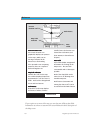
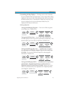
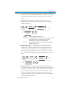
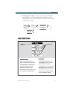
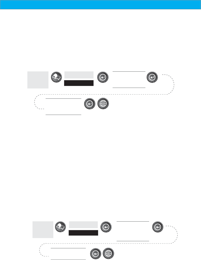
Changing the Map Orientation — You can change how the map is
orientated on the screen to either North Up, Course Up or Track Up.
Default is North Up.
From
the MAP
Screen
Highlight
Map Setup
Use arrows to
highlight the
“Orientation” field
Use arrows to select
the desired Map
Orientation
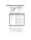
North Up North is at the top of the screen.
Course Up The heading of the active leg of the active route is at the
top of the screen. If no route is active, North Up
orientation is used until a route is activated.
Track Up Your heading (i.e., the direction you are travelling) is at
the top of the screen.
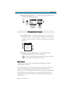
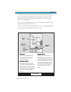
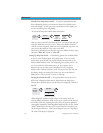
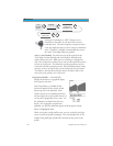
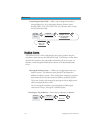
Selecting Primary Usage — The SporTrak can be set to either Land or
Marine Usage. When in Land (default), the map displays land areas in
white and water areas as dark gray. For marine applications it may be
desirable to reverse the display, showing water as white and land as dark
gray. This will make reading some of the data information on the water
easier.
From
the MAP
Screen
Highlight
Map Setup
Use arrows to
highlight the
“Primary Usage”
field
Use arrows to select
Land or Marine
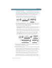
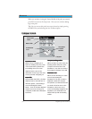
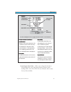
Selecting Track Mode — Allows you to set how often the SporTrak stores
track points. Setting the mode to “OFF” stops the SporTrak from saving
any new track points. In “Auto” or “Auto Detailed” mode, the SporTrak
uses a method for track point storage that maximizes memory. Using
Auto, you will see more points on and near turns and less points on
straight stretches of the map. You also have the option of selecting fixed
intervals for track point storage.