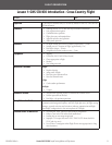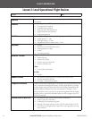
Garmin GNS 530/430 Sample Training Syllabus and Flight Lessons
190-00334-00 Rev. A
14
Garmin GNS 530/430 Sample Training Syllabus and Flight Lessons
190-00334-00 Rev. A
FLIGHT ORIENTATION
15
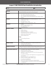
Lesson 3: GNS 530/430 Dual Installation Introduction
Student: Date:
Objective
To develop the student’s ability to properly manage an integrated dual-installa-
tion of GNS 530/430 avionics stack in an IFR environment.
Elements
a GMA 340 audio panel operations
a GNS 530/430 conguration and operation
a GTX 330 operation and TIS data interpretation
a GDL 49 operation and WX data interpretation and its relation to ight
planning
Schedule
a Pre-ight brieng and review of student’s preparations – 30 min
a Student practice – 2 hrs
a Post-ight critique – 30 min
a Assignment for further student review – 5 min
Equipment
a Airplane
a POH/AFM (appropriate Pilot’s Guide)
a Charts appropriate to ight
a Note-taking materials
Instructor’s actions
Preight
a Explain objective
a Assign route of ight
a Assign approach types to be completed
a Assign required operations using TIS and WX data
a Describe typical operation ow
a Describe common errors
In-ight
a Coach student performance
Post-ight
a Critique
Student’s actions
a Ask questions regarding objective, elements and common errors
a Perform operations as directed
a Post-ight – ask pertinent questions
Completion standards
Student should be able to complete basic tasks using all available avionics tools
to complete the ight and demonstrate function to instructor as requested.
Possible errors to watch for
a Not using the “enter” button to select stand-by frequencies
a Failure to use both COM radios
a Loading but not activating an approach
a Improper CDI output selection in GNS 530/430 (GPS when should be
VLOC and vice versa)
a Use of Direct-To navigation when Flight Plan is more appropriate for long
route clearances
a Choosing wrong request type through GDL 49
a Inability to interpret a graphical METAR request
a Not enabling cross-ll function
a Failure to use VNAV/VSR information to help plan descent
a Not setting up displays to maximize the amount of data presented without
overlapping data


