


GPSMAP 400/500 Series Owner’s Manual 17
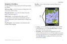
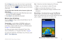
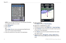
Using Charts
Press the Range (+) key to move the view closer to your boat and
lower to the water. Press the Range (-) key to move the view away
from the boat. The scale ( ) temporarily appears at the bottom
of the screen.
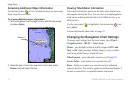
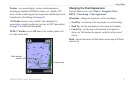
To view details about navaids such as beacons, lights, and
obstructions:
1. Use the Rocker to point to the navaid. When the cursor is over
the navaid, the navaid is highlighted.
2. Press Select to view details about the navaid.
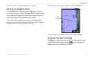
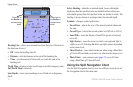
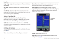
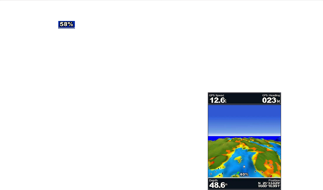
Mariner’s Eye 3D Settings
To access additional settings or options from the Mariner’s Eye 3D
screen, press Menu.
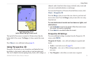
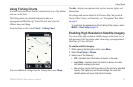
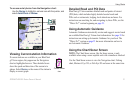
Weather Radar
—turn the display of NEXRAD weather on or
off. (The Weather feature is only available if the chartplotter is
connected to a weather module and you have an XM subscription.)
See page 55 for additional information.
For settings and options related to Waypoints & Tracks, Other
Vessels, and Data Bars, see “Navigation Chart Menu” on page 9.
To customize the appearance of the Mariner’s Eye 3D screen, select
MENU > Chart Appearance.
Style—Selects how chart data is displayed over 3D terrain.
Classic—uses color schemes to indicate 3D terrain.
Charts—provides chart information in a 3D view.
Photos—provides satellite photo imagery in addition to chart
information.
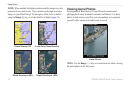
Hazard Colors—Turns hazard colors on or off. The Off setting
shows the land as seen from the water. The On setting indicates
shallow water and land with a color scale. Blue indicates deep water,
yellow is shallow water, and red is very shallow water.
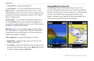
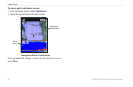
Mariner’s Eye 3D (Water Hazard Colors)
•
•
•