


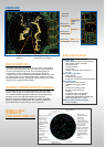
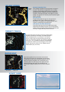
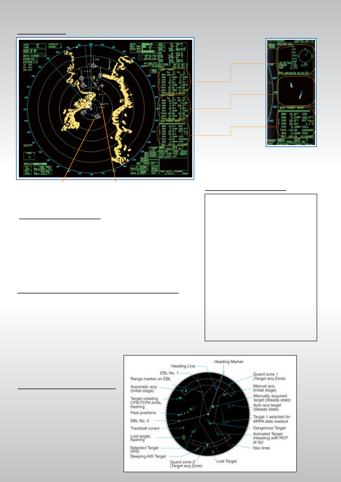
ARPA/AIS
Own ship
data cell
AIS-equipped target
selected for data reading.
Targets automatically
acquired
DATA Cell 1
Magnify
AIS
Information
Water temp,
Depth,
Wind
DATA Cell 2
DATA Cell 3
Tracking data
Tracking data
Tracking data
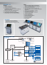
An AIS-equipped ship may be displayed by both AIS and ARPA
symbols. This is because the AIS position is measured by a GPS
in L/L while the ARPA target blip and data are measured by range
and bearing from own ship and located on the radar PPI.
When the symbols are within an operator-set criteria, the ARPA
symbol is merged in the AIS symbol. The criteria are determined
by the differences in range, bearing, course, speed, etc.
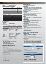
■ Static Data
MMSI (Maritime Mobile Service Identity)
IMO number (Where available)
Call sign & name
Length and beam
Type of ship
Location of position-fixing antenna on
the ship
■ Voyage related data
Ship’s draught
Hazardous cargo (type)
Destination and ETA (at masters discretion)
■ Dynamic data
Ship’s position with accuracy
indication and integrity status
UTC
Course over ground (COG)
Speed over ground (SOG)
Heading
Navigation status (manual input)
Rate of turn (where available)
Update rates Dependent on speed and
course alternation (2 s – 3 min)
■ Short safety-related messages
Free messages
A variety of navigational information, own ship status, radar plotting
data, wind, water temperature and information from other shipborne
sensors are displayed on the cells. These selected targets are
marked with a square symbol on the radar display. Magnify is
a special feature of the FURUNO radars FAR-28x7 series. This looks
like a delayed-sweep zoom that the IMO strictly prohibits, but where
the Administration accepts, the Magnify feature enlarges part of radar
display for some special maritime activity.
AIS information
DATA DISPLAY
TARGET ASSOCIATION (Fusion)
MARKS AND
SYMBOLS
FOR ARPA AND AIS