


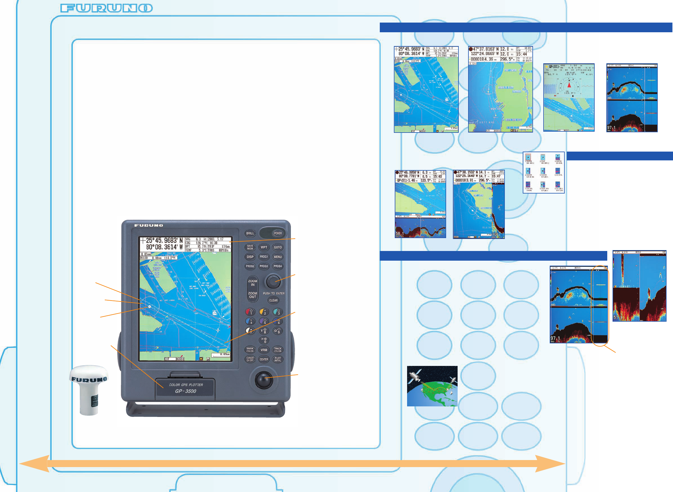
Mode selection is quite easy; push the
"DISP" button and select the mode icon
by using the "Enter knob". Up to 36
display modes including combination
mode are available. The combination mode can be
mixed and matched from primary display modes. The
primary display modes consist of course plot, compass
and sounding (GP-3500F only) mode. If those weren't
enough, the operator can arrange the display layout in
the menu.
The GP-3500 series is Furuno's new high performance
GPS/DGPS/WAAS VideoPlotter designed for a wide
variety of fishing vessels and pleasure craft. The
compact, 12-channel antenna unit offers extremely
accurate position fixes - 10 m for the basic GPS, 5 m
for the DGPS and 3 m where WAAS (or EGNOS) is
available.
The all-new processor ensures high-speed updating of
graphic presentations including the electronic chart, the
vessel's position and motion trend vector, track,
waypoints, and so forth. Up to 80,000 ship's tracks, 3,500
waypoints and 200 planned routes can be stored in the
internal memory.
Dual interchangeable card slot for chart and memory
cards are provided on the front panel. The cartography
is selectable among C-MAPNT Chart or Navionics
®
Nav-
Chart™/Furuno MiniChart containing accurate coastlines,
depth contours, place names,
aids to navigation such as buoys,
lighthouses, and other
navigational marks.
The GP-3500F employs the dual frequency 50/200 kHz
sounding module as standard. It presents detailed
information on fish, fish schools and bottom. The range
can be changed manually or automatically. When the
range is changed, an entire echogram will be redrawn so
that the contour line can be shown seamlessly. The GP-
3500F incorporates unique target position output feature.
It outputs the Lat/Lon position and depth of a target
specified by cursor and temperature data (when a
temperature sensor is connected) to the plotter display as
a mark. The information is also stored in the internal
memory.
Operation is simple and straightforward by using
softkeys, enter knob and trackball. You can operate
the navigator with great comfort thanks to its user-friendly
design.
Dual Frequency
and A-scope
Variety of display modes
Course Plot
Combination of
Course Plot and Echo Sounder*
GP-3500: GPS/DGPS/WAAS VideoPlotter
GP-3500F: GPS/DGPS/WAAS VideoPlotter with Echo Sounder
Trackball
WIDE:310 mm, HIGH:337 mm, DEPTH:120 mm
The GP-3500F incorporates a dual-frequency, 600 W or
1 kW sounding transceiver. Acoustical pulses are emitted
from the transducer fitted on the boat hull and echoes are
received from fish and bottom. The 200 kHz pulses pinpoint
fish schools in shallow water, while the 50 kHz pulses are
advantageous to search deeper water. The A-scope display
helps to evaluate echo strengths of targets in real time.
The underwater scene can be displayed in a split screen
with course plot or alone on the full size screen. A water
temperature graph can be displayed by incorporating an
optional water temperature sensor.
Compass
Selection of display modes
Enter
knob
Own ship
Ship's track
Planned
route
Dual
interchangeable
Card Slot
Electronic
divider
Nav Data
Bottom
Discrimination
Actual Size
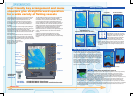
WAAS is a GPS navigation system with differential correction by means of geostationary
satellites. This is an extremely accurate system developed by the Federal Aviation
Administration (FAA) in the US. Similar systems, using Satellite-Based Augmentation
Systems (SBAS), are under development in Japan (MSAS: MSAT Satellite-based
Augmentation System) and Europe (EGNOS: European Geostationary Navigation Overlay
System). They are said to be fully interoperable and compatible.
As the WAAS utilizes the same frequency as the GPS, a single antenna can receive GPS and WAAS signals.
Currently two Inmarsat GEO satellites are available for receiving the WAAS signal: AOR-W and POR. Major
contributors of an error in a single frequency GPS system are receiver clock drift and signal delays by refraction.
The WAAS reference stations on the earth monitor the GPS constellation and route GPS error data to the satellites
via the master earth station. The Inmarsat or communication satellite broadcasts the differential corrections to
marine and aviation users.
WAAS (Wide Area Augmentation System)
User friendly key arrangement and menu
structure give straightforward operation
for a wide variety of fishing vessels
Echo Sounder*
TM North-up mode
Course-up mode
A-scope
Echo Sounder Display (GP-3500F)
*GP-3500F only
GPS/WAAS
Antenna
GPA-017S