


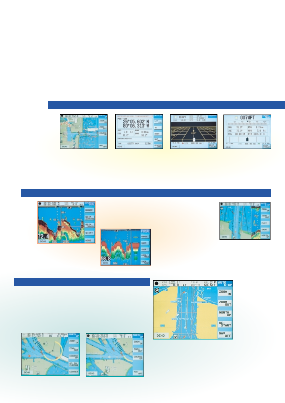
In the Auto Course-
up mode, automatic
resetting takes place
at a course change of
22.5° and the ship's
intended course is
kept at the screen top
like a head-up
display.
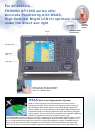
The course plot display shows your ship's position
with a motion trend vector, route, position, speed
and course. Your ship's heading and speed are
indicated by a vector at your present position.
Display colors can be changed for optimum visibility
depending on ambient light conditions.
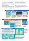
COURSE PLOT DISPLAY MODES
Four chart orientations are available in the course plot
display: True Motion North-up, Course-up and Relative
Motion North-up and Course-up modes. In the True
Motion modes, coastlines remain stationary on the screen
while your vessel moves according to its actual speed and
course. In the Relative Motion mode, your vessel stays
kept at the screen center and coastlines move relative to
your vessel.
TM North-up mode
RM North-up mode
Dual frequency
Course plot
+
Sounder
Incorporating a powerful 50/200 kHz, 600 W echo sounder
module, the GP-1650WF/1650WDF present an echogram in
addition to the course plot display. Full-screen echo
sounding modes include Normal (single- or dual-freq),
Bottom-lock, Bottom Zoom, Marker Zoom and A-scope.
Selection of sounding range,
phasing, gain, display mode,
frequency and other settings
are simple with the softkeys at
the right of the screen. A water
temperature graph can be
displayed if an appropriate
temperature sensor is provided.
TM Course-up mode (Automatic)
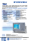
The GP-1650W series are GPS/DGPS/WAAS plotters
with video plotting and echo sounding capability
designed for pleasure craft and coastal fishing boats.
This compact and cost-effective series offers
extremely accurate position fixes - 10 m for the basic
GPS, 3 m where WAAS service is available and 5 m
with DGPS (DGPS version).
The Display modes include Course Plot, Nav Data,
Steering and Highway. The Steering mode provides
an intuitive indication of course to steer and cross-
track-error. The Highway mode is useful when you are
following a series of waypoints along a planned route.
The GP-1650WF and GP-1850WDF with the 50/200
kHz echo sounder module present detailed
information on fish and bottom. The echo sounder
data can be displayed jointly with course plot or alone
on the full size screen.
The useable chart cards are Furuno MiniChart/
Navionics
®
Nav-Chart
or C-MAPNT Chart cards.
Chart cards contain accurate spot sounding,
coastlines, depth contours, buoys, lighthouses and
other navigational features.
PRIMARY DISPLAY MODES
Nav Data
Steering mode
Highway
Most important navigational
information can be clearly
read from a distance.
Assists the vessel in following
intended course.
Useful for following legs or
segments of a planned route.
ECHO SOUNDER DISPLAY MODES (GP-1650WF/1650WDF)
Course plot
A-scope (at right)
Choice of TM North-up or
Course-up and RM North-up
or Course-up mode.
Navionics
®
Nav-Chart
C-MAPNT Chart
C-MAPNT Chart
C-MAPNT Chart
C-MAPNT Chart