


Target acquisition: Automatic or manual acquisition of up to
20 targets in 0.2-32 nm
Tracking range: 0.1-32 nm
Vector length: 0.5, 1, 3, 6, 15, 30 min, true or relative
Audio-visual alarm: Produced against lost targets and threatening
targets
Target data display: Range, bearing, course, speed and CPA/TCPA
of a chosen target
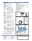
The Video Plotter RP-17 provides radar maps and storage of
navigation events on two IC cards - a memory card (RAM) for storing
the operator-created radar maps and a chart card (ROM) storing
FURUNO made digital charts. The memory card retains operator-
created radar maps of a maximum of 3,000 points. A radar map is a
combination of map lines and symbols whereby the user can define
and input the navigation data, route planning and monitoring data.
The chart card (ROM) can drive the Electronic Reference Chart
(ERC) - digital chart published by the Japanese Hydrographic
Bureau. Nav lines, coastlines, buoys, etc. produced by operator by
3000 points in Radar mode, 6000 points with 98 waypoints and 10
routes on IC card in Chart mode at intervals of 0-30 s.
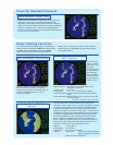
Provided with ship's heading and speed data, the FR-1505/1510/
1525 MARK-3 present true echo trails which permit intuitive
recognition of surrounding situation without smearing of stationary
targets, such as land. Relative echo trails are useful for identifying
a target on a collision course. The echo trails are displayed in
monotone or multilevel shading with a trail length selected between
15 s and 30 min, or continuously.
Radar Plotting Facilities
The new IMO Resolution defines 3 types of radar plotting
facilities: Electronic Plotting Aid (EPA), Automatic Tracking
Aid (ATA) and Automatic Radar Plotting Aid (ARPA).
All these Plotting Aids generate CPA and TCPA and
collision alerts, complying with all IMO and IEC standards.
The FR-1505/1510/1525 MARK-3 provide EPA and ATA*.
* with optional ARP-17
Electronic plotting of 10 targets according to the
new IMO and IEC standards. Automatically
redraw vectors between manual plots, drops off
vectors if not plotted more than 10 min as
required by IMO/IEC.
Powerful Standard Features
EPA (Electronic Plotting Aid)
Automatic Tracking Aid (ATA)
ARP-17 (Optional)
Video Plotter RP-17
(Optional)
Map area: 0.125 to 96 nm
Latitude limits: 85°N to 85°S
Plot interval: 0 to 30 s or 0 to 9,99 nm
Memory: Chart mode: 6000 points for track points and
marks, 98 waypoints, 10 routes.
Radar map mode: 3000 points
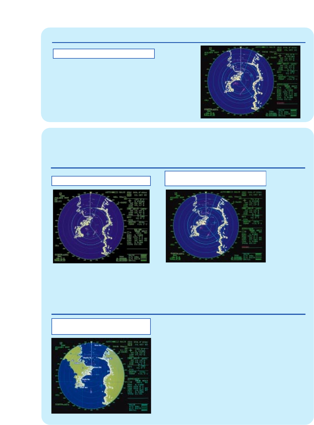
The Auto Plotter
ARP-17 automati-
cally tracks up to
20 targets
acquired manually
or automatically,
presents target
data, and triggers
a collision alarm
for the target on a
collision course.
True or Relative Target Trails
Note: ARP-17 can be used for 24 rpm scanner only.