


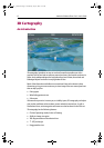

2D Chart Enhancements 5
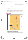
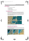
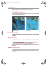
• 3D locator (see
page 21
).
• 2D/3D chart synchronization (see
page 21
).
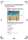
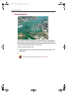
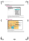
Increased coverage
• In addition to coastal regions, the Platinum chart card also covers US lakes and
inland waterways.
Changed control
• The radar overlay is now controlled via the chart layers soft key and the radar/chart
synchronization via the chart mode and orientation soft key.
Additional menu items
• The Cartography Setup Menu now includes additional menu items to cover the
new cartographic objects and the aerial photo overlay.
Notes: (1)
For further information relating to your particular display, please refer to the indi-
vidual User’s Manual.
(2)
For details of how to combine 2D and 3D features, please refer to page 20.
81259_1_NGC.book Page 5 Wednesday, July 27, 2005 11:51 AM