


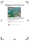
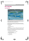
3D Cartography 15
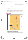
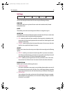
Soft keys
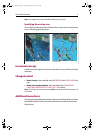
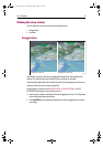
You can also change the view of the 3D chart using the following soft keys:
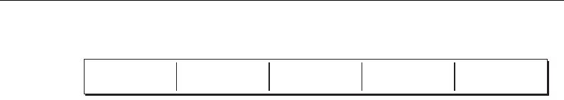
FIND SHIP
Pressing this soft key at any time will return to the active motion mode, forward
looking chart view.
GO TO
This enables you to select an existing route to follow or a waypoint to go to.
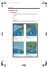
ADJUST ON
This enables you to choose which point on the screen the chart will move around when
you use the rotary control and gives the following options:
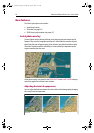
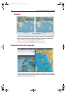
• EYE - rotates or pitches the chart around the virtual eye point, maintaining a rela-
tive position from the virtual eye point to the on-screen boat. Useful to get an aerial
overview of the terrain.
• CENTER - rotates or pitches the chart around the center-of-view cross on the chart.
Useful to view a particular feature in close up.
ADJUST
Enables you to choose how the rotary control adjusts the view and gives the following
options:
• ROTATE - enables you to rotate the chart through 360
o
. If you want to maintain a
view from a particular bearing, just use the rotary control to rotate the picture until
you see the required view. The chart will automatically update.
• PITCH - enables you to change the level at which you view the chart. This can be
from sea-level to a full aerial view. You cannot view the chart from underwater.
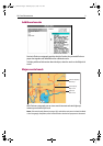
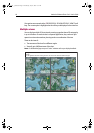
PRESENTATION
Enables you to access the following sub-menus:
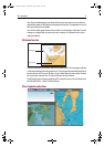
• TRANSDUCER CONE
If you have a fishfinder in your system, you can display the transducer cone to indi-
cate the area that it covers on the 3D chart. This is useful when fishing as it enables
you to compare the chart view with the information your fishfinder is showing you.
• DEPTH SCALE
You can display a line under your boat to indicate the depth. However, remember
that this depth is only approximate, a more accurate reading of depth is available
elsewhere in your system.
FIND SHIP GO TO...
ADJUST ON
EYE CENTRE
ADJUST
ROTATE PITCH
PRESENTATION...
D8053_1
81259_1_NGC.book Page 15 Wednesday, July 27, 2005 11:51 AM