


5-8 hsb
2
PLUS Series LCD Display
Working with
Waypoints
5.3 Working with Waypoints
Introduction
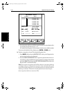
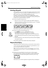
The Chartplotter enables you to place up to 998 waypoints (in addition,
waypoint number 999 is used for MOB operation): a waypoint is a position
enteredona chartas areference,or asa place togoto.All waypointsplacedon
the chartplotter arestored in a waypoint database listwhich includes symbol,
position,bearing, range and additional data.All waypoints inthe database are
displayed on the screen, unless you set waypoint display off in the Chart Set
Up menu, as described in Chapter 7. You can select a waypoint, either on-
screen or from the list, for editing.
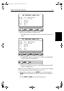
A waypoint can be placed at the cursor position, or at the vessel’s current
position (this is sometimes known as an event mark); a waypoint at the vessel
position includes additional information (if available) on the depth and
temperature when it was placed. Alternatively, you can manually enter
Waypoints as either Lat/Long coordinates or Loran TDs which are
automatically converted into Lat/Long coordinates. All waypoints can be
included in a route. You can place waypoints, using simulator mode, before
you install the chartplotter on your vessel.
Note: Radar marks mayalso bedisplayed onthe screenif your chartplotteris
a combined radar/chartplotter or is part of an integrated system; these are
screen annotations - you cannot GOTO marks, nor include them in routes.
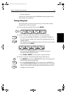
When you place a new waypoint, it is displayed using the default symbol of a
cross (unless you have changed the symbol in Chart Set Up). The waypoint is
added to the waypointlist and taggedwith the nextavailable number. You can
use the edit functions to change the symbol and name. When the cursor is
positioned over a waypoint, the waypoint bearing and range are displayed.
Waypoints in the current route are available onother SeaTalkinstruments that
supportcurrentroute transfer, forexample,anotherRaymarineChartplotteror
ST80 Masterview. You can transfer waypoints between the chartplotter and
other NMEA or SeaTalk instruments using the Waypoint Transfer functions.
You can also save waypoints to, or load them from, a user cartridge. These
functions are described in Section 5.6.
This section explains how to perform the following tasks using the on-screen
cursor and the waypoint list:
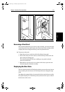
• Placing a Waypoint
• Selecting a Waypoint
• Displaying Waypoint data
• Editing a Waypoint (symbol, name & position)
• Erasing a Waypoint
81186_3.book Page 8 Thursday, August 22, 2002 8:23 AM