


70 A60 Dual Function Display
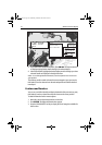
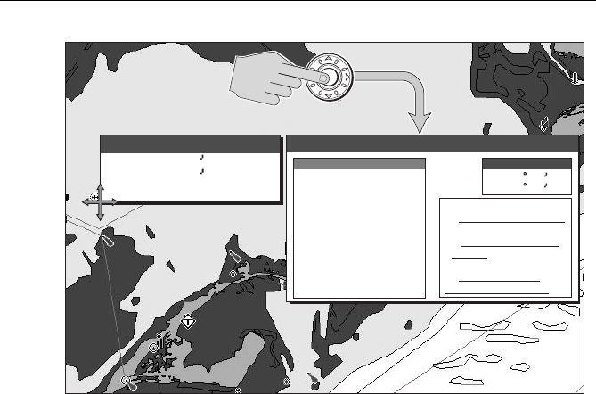
3. If you desire more detailed information, press ENTER. The Object Info box is
re-displayed giving further details relating to the selected object.
4. In the left-hand box, highlight the desired subject area for the object you have
selected. Details are displayed in the right-hand box.
Note:
To scroll through detailed information, use the trackpad to move control to the
right-hand box.
The soft keys provide controls to locate the nearest waypoint, port, port service,
tidal station, wreck or obstruction to the selected position and obtain data for a
named port.
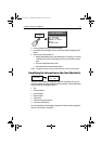
Features and Services
You can use your A60 to identify and display the details of the port services, ports,
tidal stations, wrecks or obstructions that are closest to the cursor position.
To obtain information for the nearest objects:
1. Move the cursor to the desired position on the chart.
2. Press ENTER. The Object Information box appears.
3. Press the FIND NEAREST soft key to display the list of categories available for
this function:
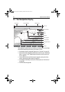
D9836-1
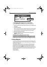
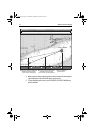
N 25° 18.160
W 080° 19.397
Wreck
Object Information
N 25 18.160
W 080 19.397
Category of wreck
Dangerous wreck
Vertical datum
Mean lower low
Water level effect
Always under
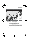
Position
Wreck
Depth area
Control zone
Restricted area
water/submerged
ENTER
Object Information
Object Information
Object Information
water
Position
81295.book Page 70 Wednesday, December 20, 2006 2:48 PM