


49
Chapter 3: Working with Waypoints
3.1 Introduction
Waypoints are a core feature of the A60 display. They can be created in the Chart
or Fishfinder application and used by each application. Waypoints can be stored in
the system, archived to a CompactFlash card or sent to or received from another
NMEA compatible instrument. To make full use of waypoint features, ensure your
display is receiving heading and position data.
This chapter gives details of how to place, edit, manage and navigate to a
waypoint using the dedicated WPTS/MOB key.
A waypoint is a position marked on a chart or fishfinder window to indicate a site
(for fishing, diving etc.) or as a place to navigate to.
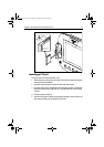
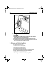
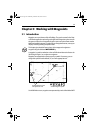
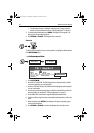
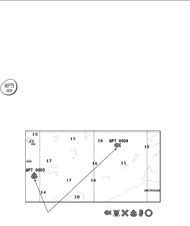
Waypoints are represented on chart screen by a symbol. If necessary, you can
change this symbol from the default (‘X’) to a more appropriate one.
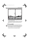
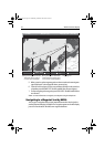
On the fishfinder screen, waypoints are represented by a vertical line labeled WPT:
D8467-2
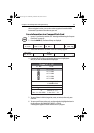
Available Waypoint Symbols
Example Waypoints shown
with symbol and name
81295.book Page 49 Wednesday, December 20, 2006 2:48 PM