


Chapter 3: Standard Chart Operations 3-1
Introduction
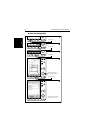
Chapter 3: Standard Chart Operations
3.1 Introduction
This chapter explains how to use the chart functions to navigate with your
display. It covers the following topics:
• Using chart cards.
• Controlling waypoints, including placing, moving, editing and deleting
waypoints.
• Working with routes, including creating a new route, managing routes
using the route database and editing routes.
• Following routes and going to waypoints.
• Transferring Waypoints and Routes
• Usingtracks,includingshowingtracks, settinguptracks, savingtracks and
creating a route from a track (SmartRoute).
All these chart functions are available in plotter mode, so you can plot and
track routes at large scales even when a chart card is not installed.
Further functions, including measuring distances and setting alarms are
described in Chapter 4.
Safety
The chartplotter makes it very easy to place a waypoint and travel towards it.
However, you should always check first that the route is safe. If you are using
the chartplotter in combination with a SeaTalk autopilot, the autopilot will
prompt for confirmation before it steers the vessel towards the waypoint.
If you have entered your route using a small-scale chart, zoom in to a larger
scale to check for hazards, such as small shoals, that may not be shown on the
smaller scale charts.
Note: Until you are familiar with interpreting the chart display, you should
take every opportunity to compare the displayed objects with visual targets,
such as buoys and coastal structures. You should practice harbour and coast-
al navigation during daylight and in clear weather conditions.
CAUTION:
The equipment should not be used as a substitute for good navigational
practice nor for official government paper charts.