


22 Magellan GPS 315/GPS 320
The Reference section contains information that will help
you navigate using your receiver. Now that you have read
the Basic Operation section, you have reviewed the basic
usage. The Reference section will cover waypoints, routes,
and auxiliary functions.
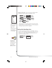
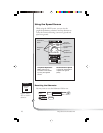
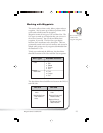
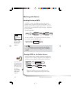
The Working with Waypoints section tells you how to
create, edit, delete, project and sort waypoints. These
functions will guide you in the uses of waypoints. You can
create your own waypoints (known as User waypoints) or
use the waypoints already in the receiver’s memory (Non-
User waypoints). You can store up to 500 user positions
which can be used to build routes for navigation.
As stated earlier in the user manual, the GPS 315 has a
database of worldwide cities and the GPS 320 has a
database of cities and marine navaids for three different
regions of the world: North/Central/South America,
Europe/Africa and Australia/Asia.
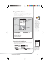
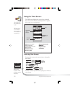
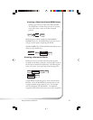
The Working with Routes section tells you of the four
different types of routes consisting of GOTO, BACK-
TRACK, MOB and MULTI-LEG ROUTE. A route is a
planned course of travel defined by a series of waypoints
saved in the receiver’s memory. The receiver holds 20
routes with 30 legs. The route function allows you to
create, activate/deactivate, view/edit or delete any one of
the 20 routes.
The Auxiliary Function section tells you how to select the
Sun/Moon and Fish/Hunt options, contrast, simulate
mode and the alarms and message functions. You can
choose from the Anchor alarm, Arrival alarm, XTE alarm,
Proximity alarm and GPS Fix alarm. These alarms can be
reset to the alarm default settings or can be cleared of
defaults.
Following, you will find the Customizing section. Cus-
tomizing allows you to use the Setup menu to establish
the options you would like to set in your receiver.
Reference