


Magellan GPS 315/GPS 320 13
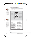
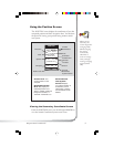
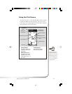
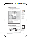
Using the Plot Screen
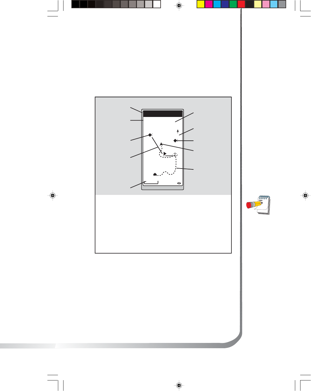
The PLOT screen is a mini map that shows where you have
traveled and where you want to travel. You can view the
active route, your current position and the other waypoints
and destination in the PLOT screen.
TO: FISH
BRG
351
m
DST
3.52
m
I
2.0
m
I
N
HOME
FISH 2
FISH
DOCK
BUOY
°
Distance to
Destination
North Indicator
Waypoint Icon
Current Position
Icon
Track History
Plot Scale
Active Route
Destination Icon
Bearing to
Destination
Destination
Name
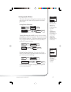
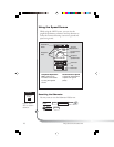
Active Route
Indicates the direction
required to reach your
destination.
Plot Scale Can be
changed by using the
left/right arrows. The
scale ranges from .1 to
200 miles.
PAN-N-SCAN, an
additional feature,
allows you to scroll
through the PLOT
screen enabling you
to create waypoints
and GOTOs.
Track History
Automatically records
where you have been.