


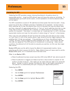

Preferences
59
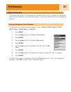
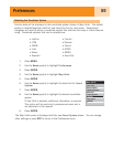
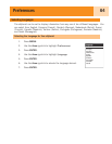
Selecting the Coordinate System
Position data will be displayed in the coordinate system chosen in Map Units. The default
system is latitude/longitude (Lat/Lon) and should be fine for most users. Experienced
navigators will want to select a coordinate system that matches the maps or charts they are
using. Coordinate systems that can be selected are:
• Lat/Lon
• UTM
• OSGB
• Irish
• Swiss
• Swedish
• Finnish
• German
• French
• USNG
• MGRS
• User Grid
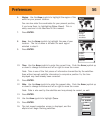
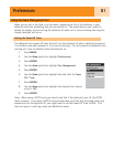
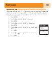
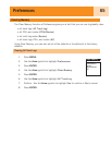
1. Press MENU.
2. Use the Arrow joystick to highlight Preferences.
3. Press ENTER.
4. Use the Arrow joystick to highlight Map Units.
5. Press ENTER.
6. Use the Arrow joystick to highlight the data field for Coord
System.
7. Press ENTER.
8. Use the Arrow joystick to highlight the desired coordinate
system.
If User Grid is selected, additional information is required.
This option will be used only by experienced users and is
not described in this manual.
9. Press ENTER.
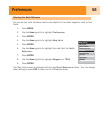
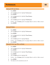
The
Map Units
screen is displayed with the new Coord System shown. You can change
other settings or press ESC to return to the
Preferences
menu.
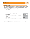
Map Units
Miles/Ft/MPH
Magnetic
Nav Units
North Reference
Coord System
Map Datum
Lat/Lon
WGS84