


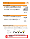
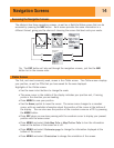
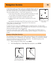

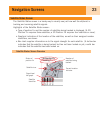
In the Cursor mode, you have a cursor icon displayed that you can use
to pan around the plotter. The information displayed at the bottom of
the screen provides you with the heading and distance of the cursor
from your present position. In the Cursor mode you can:
• scroll around the plotter, checking available information for areas
on the plotter not displayed around your present position
• create a POI for the position indicated by the cursor
• create a GOTO route to the position indicated by the cursor
location
• get detailed information about POIs found at the cursor location
These options will be explained in the section of this manual on
creating POIs and GOTO routes.
To enter the Cursor mode, use the Arrow joystick to move the cursor. As soon as the
joystick is moved, a crosshair cursor is displayed and the bottom of the screen changes to
provide information about the cursor position.
To exit the cursor mode, press the ESC button. When pressed, the
Plotter
screen is
returned to the Position mode, with your present position displayed in the center of the
screen.
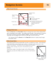
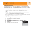
Showing or Hiding Map Information
The information at the bottom of the
Plotter
screen provides you with information that can
be used to assist you in navigating to your destination. However, you may want to display
more of the plotter and may not need this information. The eXplorist gives you the
capability to turn this information on or off.
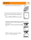
1. While viewing the
Plotter
screen, press MENU.
2. With Hide Map Info or Show Map Info highlighted, press ENTER.
Navigation Screens
16
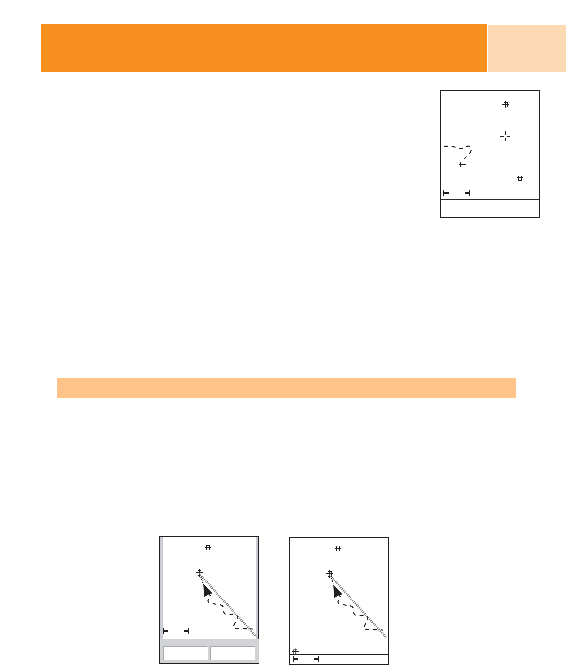
1.60mi
077
o
M
6.9
M
I
Cursor
Ranger
CA
Par
The Plotter screen in the
Cursor Mode
1.60mi
351
o
M
3.9
M
H
Heading
Speed
OakTree
QUAIL
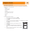
1.60mi
OakTree
QUAIL
MARKER
The Plotter screen with
plotter information shown
The Plotter screen with
plotter information hidden