


77
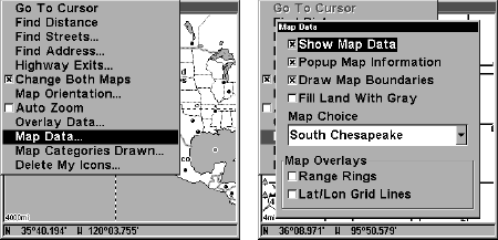
Map Data
This menu lets you turn the map off, if desired (which turns the map
screen into a GPS plotter); turn off or on the pop-up map info boxes;
draw the map boundaries or boxes around the areas of high detail; or
fill land areas with gray. You can also turn on or off Map Overlays,
which display latitude and longitude grid lines or range rings on the
map. This menu lets you select Navionics Maps; for instructions, see
the Navionics Charts entry in this section.
To get to Map Data:
From the Map Page, press
MENU
|↓ to
M
AP
D
ATA
|
ENT
.
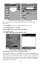
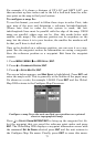
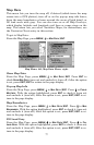
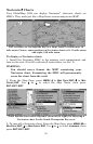
Map Menu, left, Map Data Menu, right.
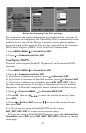
Show Map Data
From the Map Page, press
MENU
|↓ to
M
AP
D
ATA
|
ENT
. Press
ENT
to
check
S
HOW
M
AP
D
ATA
(turn on) and uncheck it (turn off.) After the option
is set, press
EXIT
|
EXIT
to return to the page display.
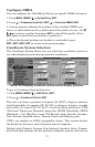
Pop-up Map Info
From the Map Page, press
MENU
|↓ to
M
AP
D
ATA
|
ENT
. Press ↓ to
P
OPUP
M
AP
I
NFO
. With the option highlighted, press
ENT
to check it (turn on)
and uncheck it (turn off.) After the option is set, press
EXIT
|
EXIT
to re-
turn to the page display.
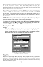
Map Boundaries
From the Map Page, press
MENU
|↓ to
M
AP
D
ATA
|
ENT
. Press ↓ to
M
AP
B
OUNDARIES
. With the option highlighted, press
ENT
to check it (turn on)
and uncheck it (turn off.) After the option is set, press
EXIT
|
EXIT
to re-
turn to the page display.
Fill Land Gray
From the Map Page, press
MENU
|↓ to
M
AP
D
ATA
|
ENT
. Press ↓ to
F
ILL
L
AND
G
RAY
. With the option highlighted, press
ENT
to check it (turn on)
and uncheck it (turn off.) After the option is set, press
EXIT
|
EXIT
to re-
turn to the page display.