


20 GPSMAP 400/500 Series Owner’s Manual
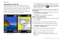
Using Charts
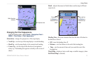
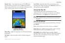
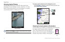
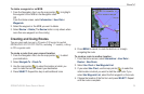
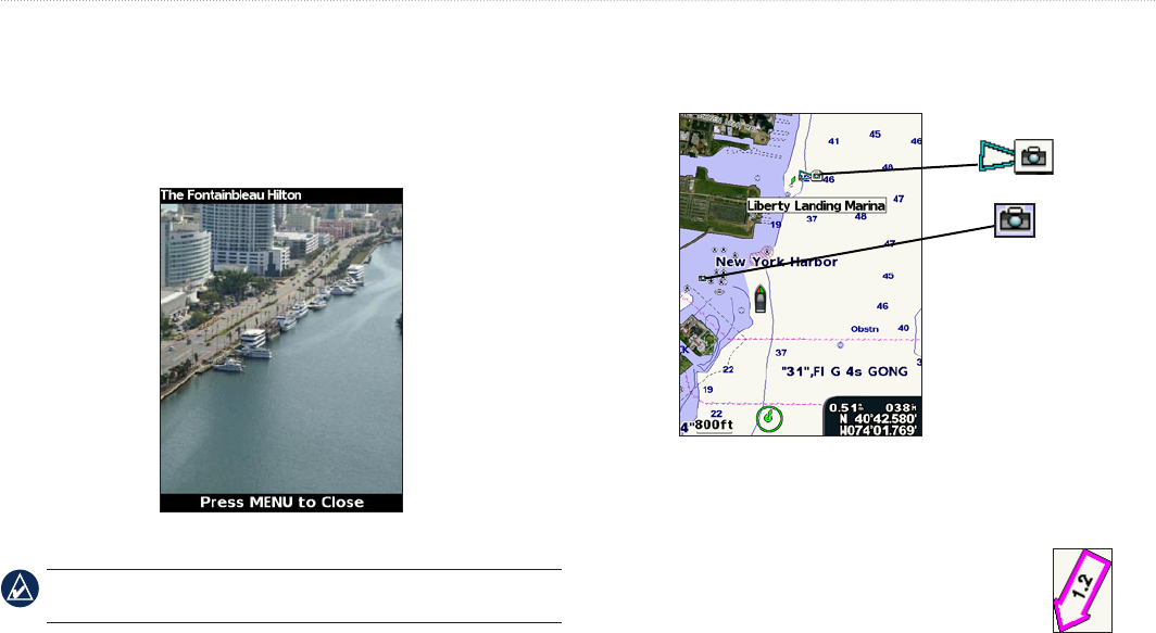
Viewing Aerial Photos
Preprogrammed BlueChart g2 Vision SD cards contain aerial
photographs of many landmarks, marinas, and harbors. Use these
photos to help orient yourself to your surroundings or to acquaint
yourself with a marina or a harbor prior to arrival.
Aerial Photo
NOTE: Use the Range (-/+) keys to zoom in and out while viewing
the aerial photo on the full screen.
To access aerial photos from the Navigation chart:
Use the Rocker to highlight a camera icon with the pointer, and
select Aerial Photo or Review.
Perspective
Overhead
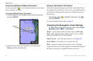
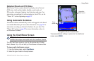
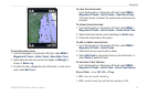
Viewing Current-station Information
If current stations are available in your BlueChart g2 Vision region,
they appear on the Navigation chart as highlighted
arrows. These detailed icons show the speed and
direction of the current at a glance. Select Review or
the name of the station to display a current graph.
Current-station
icon