


GPSMAP 400/500 Series Owner’s Manual 19
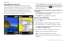
Using Charts
For settings and options related to Full Screen Map, Waypoints &
Tracks, Other Vessels, and Data Bars, see “Navigation Chart Menu”
on page 9.
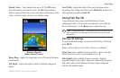
To customize the appearance of the Fishing Chart screen, select
MENU > Chart Setup (page 12).
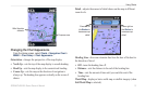
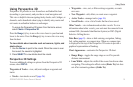
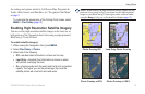
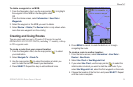
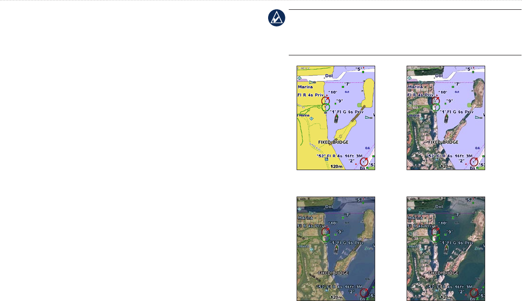
Enabling High Resolution Satellite Imagery
You can overlay high-resolution satellite images on the land, sea, or
both portions of the Navigation chart when using a preprogrammed
BlueChart g2 Vision SD card.
To enable satellite imagery:
1. While viewing the Navigation chart, press MENU.
2. Select Chart Setup > Photos.
3. Select one of the following:
Off—standard chart information is shown on the map.
Land Only—standard chart information is shown on water
with photos overlaying the land.
On—photos overlay both the water and the land at a specied
opacity. The higher you set the percentage, the more the
satellite photos will cover both land and water.
•
•
•
NOTE: When enabled, the high-resolution satellite images are only
present at lower zoom levels. If you cannot see the high-resolution
images in your BlueChart g2 Vision region, either zoom in further
using the Range (+) key, or set the detail level higher (page 13).
Photo Overlay Off Land Only Photo Overlay
Photo Overlay at 50% Photo Overlay at 100%