


14 GPSMAP 400/500 Series Owner’s Manual
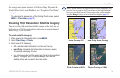
Using Charts
Spot Depths—turns spot soundings on or off and sets a dangerous
depth.
Safety Shading—identies a selected depth. Areas with depths
shallower than the specied value are shaded in blue while areas
with depths greater than the specied value are shaded in white. The
shading is always drawn at, or deeper than, the selected depth.
Symbols—changes symbol preferences.
Navaid Size—adjusts the size of the navaid symbols shown on
the map.
Navaid Type—selects the navaid symbol set (NOAA or IALA).
Land POIs
—turns the display of land POIs (points of interest)
on or off.
Light Sectors—turns the sector in which a navigational light is
visible on or off. Selecting On lters out light sectors depending
on the zoom level.
Chart Borders
—turns chart borders on when using a BlueChart
g2 Vision SD card and you want to see what area the maps cover.
Photo Points—turns camera icons (page 20) on or off when
using a BlueChart g2 Vision SD card.
•
•
•
•
•
•
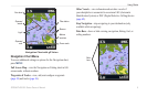
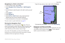
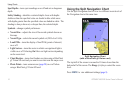
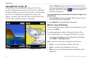
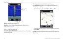
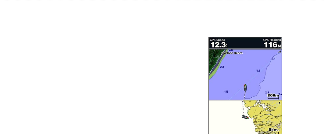
Using the Split Navigation Chart
Use the Split Navigation chart to view two different zoom levels of
the Navigation chart at the same time.
Split Navigation Chart
(with a BlueChart g2 Vision card)
The top half of the screen is zoomed in 10 times closer than the
bottom half of the screen. The Range (-/+) keys control the zoom
level.
Press MENU to view additional settings (page 9).